The oldest map in the world sells for 8.5 billion
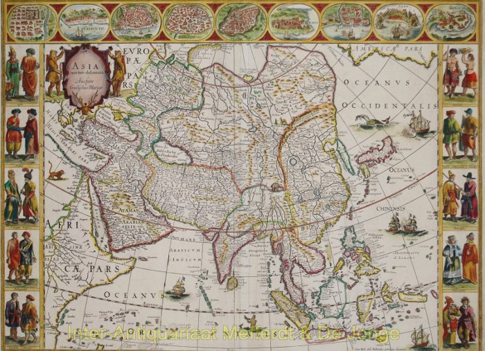
One of the oldest maps in the world produced in Amsterdam, the Netherlands is expected to be sold for £ 270,000 (about VND 8.5 billion) in April.

Great Major has 9 books with more than 600 maps, descriptive drawings.
The hand-colored map is the most expensive edition from the 17th century, even higher than Rembrandt's painting at the time.
The book was produced in Amsterdam in 1660 and in the 17th century, no edition was as expensive as it was. Chapter 4 of the book focuses on England and Wales and 58 maps of the world-famous Stonehenge.

Map of the Great Major drawn by Johannes Blaeu since 1660.
Johannes Blaeu succeeded his father Willem Blaeu, in charge of mapping the Dutch East India company. At that time, Amsterdam was the world's largest map production center.
After the great journeys of Columbus and Vasco de Gama, the door to the new world is wider than ever. The period of great discoveries helped Blaeu's map become an iconic work of the time of eternity.
The Dutch version of the atlas belongs to the rich family of Van de Werbes in Antwerp, Belgium. From the Dutch version, Great Major is translated into Latin, French, German and Spanish. On April 26, the atlas will be sold at the prestigious Sotheby auction house.

The hand-colored edition is very sophisticated.
Initial valuation of the map will be £ 270,000 (more than VND 8.5 billion).
David Goldthopre, in charge of Sotheby's book auction, believes Blaeu's masterpiece represents "the pinnacle of a 17th-century map". David shares: "This is the best atlas ever published and has been sold widely across Europe". In addition, the atlas is also translated into many other popular languages.
- Not Everest, this is the oldest mountain on Earth
- 14 oldest ancient artifacts in the world
- The oldest man in the world died, aged 112 years
- 10 oldest antiquities in the world
- The oldest fossil on Earth
- The 3.7-billion-year-old fossil signals life on Mars
- The oldest galaxy formed from 13.55 billion years ago
- The oldest eel in the world died
- The oldest man in the world has yet to feel old
- The world's oldest man welcomes his 112th birthday
- The 114-year-old woman is the oldest woman in the world
- Find the oldest living body in the world
 Discovered an ancient centipede fossil 99 million years old
 Discovered bat-like dinosaurs in China
 Discovered a 200-year-old bronze cannon of the coast
 Discover 305 million-year-old spider fossils