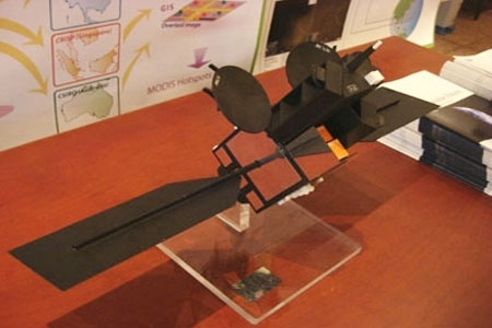
2014: Vietnam will launch satellite remote sensing
One day before the 50th anniversary of the first flight into space, April 12, representative of the Space Technology Institute (Vietnam Academy of Science and Technology), said in 2014, Vietnam will launch the first remote sensing satellite. Priority service for observation, management of natural resources, environment and natural disasters.

VNREDSat - 1 satellite weighing 130 kg will launch two years later.
In the framework of the project "Vietnam Small Satellite monitoring natural resources, environment and natural disasters (VNREDSat-1) ", in early 2009, the Prime Minister agreed to choose France as a technology provider and Official development assistance (ODA) to implement this project.
VNREDSAT-1 project has a total investment of 55.8 million euros from the official development assistance (ODA) loan of the French Government and 64 billion VND 820 million of counterpart funds of Vietnam. The project includes 10 main categories including VNREDSAT-1 satellite launch vehicle; insurance coverage; hire supervision consultant to implement the operation and exploitation project.
According to Assoc. Prof. Dr. Doan Minh Chung, Director of the Institute of Space Technology (STI), Vietnam's first remote sensing satellite will be designed and assembled in 2012 and 2013. It is expected that by 2013-2014 launch into orbit. Compared to a long time, since 1980 when Vietnam space technology is strong, this is a great step. Within 6 years, since April 2008, when the VINASAT1 satellite was launched into orbit, we could launch two fruits while, 24 years earlier, we could not deliver any fruit.
If successfully launched VNREDSat-1, Vietnam will officially have satellites to observe Earth. But due to the harsh cosmic environment, the average life span of this 130 kg satellite is only about 5 years, while the investment cost is not small.
15 young engineers have been recruited to France to receive technology in 1-2 years and start the satellite production phase. Vietnamese engineers will both learn and directly participate in satellite assembly in France. This stage has great significance, helping them quickly access to space technology that should have taken several decades to achieve as countries.
However, the problem with the satellite's mind includes computational software, it seems that we still have to rely on partners. That, according to a technology expert, almost means that it is difficult to fully guarantee the sovereignty of exploiting and securing information from this satellite even if our engineers will join write some support software. Completing the manufacturing phase, will arrive at the launch stage by another partner responsible. Who is that partner, where the launcher has yet to be revealed.
The sooner the activity is, the less it will help
Typically, a satellite image is purchased by Vietnamese agencies for 2,000 - 5,000 USD / photo and takes at least one to two months to receive. Information and data such as storms, floods, forest fires, oil spills, are often not updated quickly and frequently. Therefore, those photos can only be used for analysis and research in a context that does not coincide with real time. According to calculations, the budget for buying remote sensing images of economic sectors in our country annually reaches millions of USD. Because there is no uniform point, everyone buys. Even if this agency already exists, other agencies do not know, still go to buy so the exploitation and use are ineffective.

For a long time, Vietnam still has to buy remote sensing images with expensive prices (satellite images capture a corner of Quang Ba district, Ha Giang).
Many people expect, when launching satellite remote sensing and remote sensing image acquisition station, we will save a lot of money to spend every year. Although, according to some experts, the limitation of VNREDSAT-1 is not to capture images in all weather conditions such as satellites using sensor radar.
NREDSat - 1 weighs about 130 kg, can observe the Earth at an altitude of nearly 700 km, capable of shooting high resolution images. Satellites have receivers to capture ground images from above. The definition of these images depends on the weather and the resolution of the receiver. According to the trajectory, every 3 days, the satellite returns to its original point
VNREDSat-1 project started 7 years ago. The Prime Minister assigned the Vietnam Institute of Science and Technology to take full responsibility to implement the Project in order to serve the Research and Application of Space Technology to 2020. If considering satellite remote sensing, specializing in photography, studying the Earth, and managing natural resources, this is the first satellite in Vietnam. But if the VINASAT1 satellite (launched in orbit three years ago with the cooperation of US aircraft manufacturer, Lockheed Martin) specializes in providing telecommunications services, this will be the second satellite of Vietnam.
- Vietnam will have a second remote sensing satellite
- Why doesn't Vietnam have satellite remote sensing?
- VNREDSat-1 satellite leaves the launch pad successfully
- Defer launch of VNREDSat-1 satellite because of rain
- Simulation of the journey of Vietnam remote sensing satellite
- VNREDSAT-1 will be launched in the morning of May 7
- Vietnam successfully processed satellite remote sensing images
- Vietnam is about to launch a US $ 72 million satellite to space
- Vietnam's first remote sensing satellite is about to enter the universe
- VNREDSat-1 satellite images fly into space
- Enhance French-Vietnamese cooperation on space technology
- China launched a satellite to investigate land resources
 Van Allen's belt and evidence that the Apollo 11 mission to the Moon was myth
 The levels of civilization in the universe (Kardashev scale)
 Today Mars, the sun and the Earth are aligned
 The Amazon owner announced a secret plan to build a space base for thousands of people