An Giang applies remote sensing images to rice production
An Giang province has just completed a scientific research project "Application of WEBGIS technology and remote sensing images to manage the progress of seeding and warnings on rice pest control in An Giang province" by Associate Professor and Doctor Vo Quang Minh - Can Tho University is the director.
The thesis has helped to find solutions to manage rice crop by remote sensing method , timely warning of rice pests, quick response and help farmers effectively prevent by using WEBGIS method .

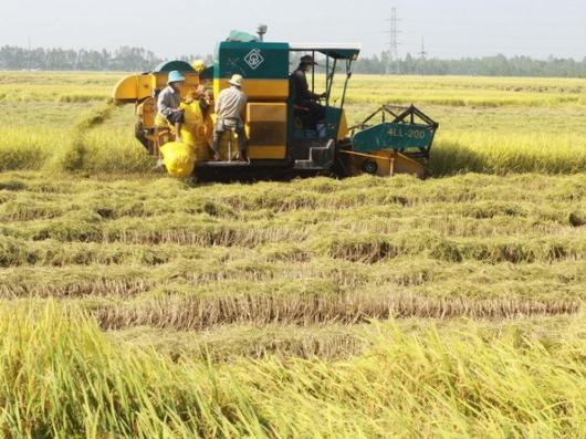
Farmers in An Phu district (An Giang) harvest rice.(Photo: Thanh Vu / VNA)
The project was implemented from 2011-2013, focused on researching 3 contents such as monitoring the progress of rice seeding down by remote sensing method; collect baseline data by farmer survey method; build database management system software by WEBGIS method; training of collaborators to collect information periodically; survey, collect periodic information by sample form; GIS method; WEBGIS method; professional solution.
From the results of this study, the project team has established the current status map of the rice crop structure in An Giang province, including 8 different rice cultivation structures; establishing 4 progress maps of rice seed in An Giang province corresponding to 4 autumn-winter rice crops, winter-spring, summer-autumn and autumn-winter crop (in 2011-2012); established a chain of 69 rice tea maps and 69 pest warning maps on rice fields every 8 days / cycle .
After finishing, acceptance of the research topic 'Application of WEBGIS technology and remote sensing images to manage the progress of seeding and warnings of rice pest control in An Giang province' was transferred to the Department of Agriculture and Rural Development. An Giang village application.
- Vietnam successfully processed satellite remote sensing images
- An Giang promotes the application of scientific and technical advances in production
- Complete remote sensing system to monitor Hoang Sa and Truong Sa
- Kien Giang recommends limiting IR50404 rice cultivation
- Tien Giang will mass produce specialty coal rice
- Vietnam will have a second remote sensing satellite
- Detection of anomalous
- The 26th Asian Remote Sensing Conference and Asian Space Conference
- Why doesn't Vietnam have satellite remote sensing?
- Taiwan successfully developed multicolored rice
- Certification of trademark for Huong Dien rice variety
- Successful production of a red dust rose rice
 'Barefoot engineer' invents a pipeless pump
 Process of handling dead pigs due to disease
 Radiometer
 Warp Engine: Technology brings us closer to the speed of light