Banyan storm weakened and suddenly
After crossing the Philippine Islands, Typhoon Banyan weakened into a tropical depression. But when entering the East Sea, the tropical depression suddenly got stronger.
Forming coastal off-central Philippines, on October 13, after crossing this archipelago, Banyan storm weakened into tropical depression and entered the East Sea. However, according to meteorological agencies, when entering the East Sea, the tropical low pressure area has been energized and will become strong again. At 13:00 today (October 13), the position of the tropical depression center is about 13.5 degrees north latitude; 119.0 degrees east longitude. The strongest wind in the area near the center of strong tropical low pressure level 7, level 8, level 9.
It is forecasted that in the next 24 hours, tropical depressions will move to the northwest and are likely to become strong storms. At 13:00 on October 14, the location of the center of the storm was about 16.2 degrees Vi Bac; 116.8 degrees Kinh Dong, on the east coast of the East Sea, about 530km from Hoang Sa archipelago to the East of Southeast. The strongest wind is in the area near the center of the storm with level 8, level 9, level 10.
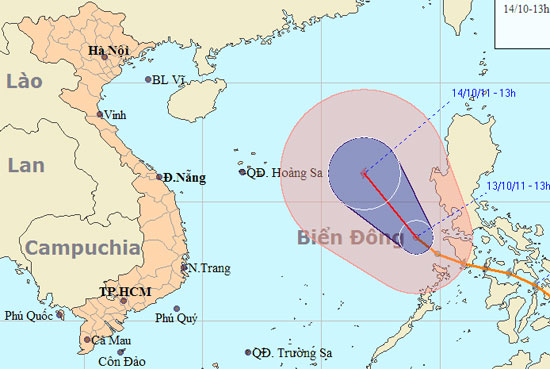
Journey to cross the sea storm storm Banyan. Click on the image to see a larger image. (Photo: NCHMF)
According to meteorological experts, from this afternoon, due to the impact of tropical depression, the East Sea in the North and the Middle East Sea has strong winds gradually up to level 6, level 7, then increase to level 8, shock level 9, 10. Sea level is very strong.
In addition, the cold air section continues to move south. Gradually morning and tomorrow (October 14) will affect our northern provinces. Due to the influence of cold air, the North and North Central regions have rain, showers and scattered thunderstorms. Northeast wind in the Gulf of Tonkin will gradually increase to level 5, sometimes level 6, level 7 shock.
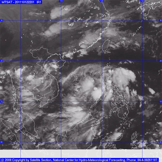
Image of satellite cloud storm Banyan (Photo: NCHMF)
- Strong Banyan storm level 8 on the East Sea
- Storm and low pressure, Central rain again
- Storm No. 1 weakened into tropical depression, the North continued to have small rain
- The world's largest banyan tree
- Typhoon Tembin weakened into a tropical depression
- Suddenly No. 6 storm
- Storm No. 6 weakened into a low pressure area, the North continued heavy rain
- Typhoon Khanun weakened into a tropical depression
- Storm No. 14 weakens into a tropical depression
- Storm No. 9 has weakened into a tropical depression
- Washi weakened into a tropical depression
- Seventh storm weakened into low pressure, from the afternoon of August 28, Bac Bo had a large rain
 Is the magnetic North Pole shift dangerous to humanity?
 Washington legalizes the recycling of human bodies into fertilizer
 Lightning stone - the mysterious guest
 Stunned by the mysterious sunset, strange appearance