Environment
Usagi super typhoon in the strongest year entered China
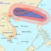
At 01:00 on September 21, the location of the center of the storm was about 20.4 degrees north latitude; 122.6 degrees east longitude, about 250km from the island of Leb…
Browse ScienceInfo articles and explainers related to PER.
374 published items.
At 01:00 on September 21, the location of the center of the storm was about 20.4 degrees north latitude; 122.6 degrees east longitude, about 250km from the island of Leb…
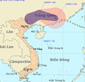
At 04:00 on September 23, the location of the center of the storm was about 23.3 degrees Vi Bac; 113.2 degrees east longitude, about 140km from Hong Kong (China) to the…
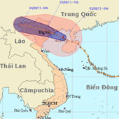
Last night (August 2), Typhoon 5 crossed North Hainan Island (China), went into the Gulf of Tonkin. At Bach Long Vi island station, a strong wind of 17m / s (level 7) wa…
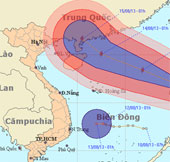
At 01:00 on 12/8, the location of the storm center is about 16.2 degrees Vi Bac; 122.2 degrees Kinh Dong, on the southeastern region of Lu - Dong (Philippines).
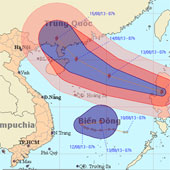
At 07:00 on 12/8, the location of the center of the storm was about 16.6 degrees north latitude; 120.9 degrees Kinh Dong, on the mainland of Lu - Dong Island (Philippine…
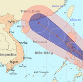
At 7 o'clock on June 29, the location of the center of the storm is about 11.5 degrees North latitude; 125.4 degrees Kinh Dong, in the central region of the Philippines.…
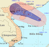
At 13 o'clock, the location of the center of the storm is about 18.5 degrees north latitude; 115.4 degrees Kinh Dong, about 400 km from Hoang Sa archipelago to the East…
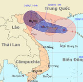
At 04 hours on June 22, the location of the center of the storm is about 19.5 degrees North latitude; 112.3 degrees Kinh Dong, on the eastern area of Hainan Island (Ch…
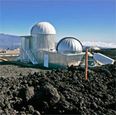
Mauna Loa is the oldest monitoring station for carbon dioxide (CO2) in the world located on Mauna Loa volcano in Hawaii.
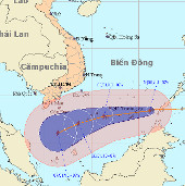
At 7:00 on January 4, the location of the center of the storm was about 8.4 degrees North; 116.2 degrees Kinh Dong, about 470 km from Truong Sa Lon (belonging to Truong…
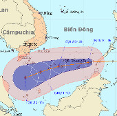
At 10 o'clock on January 4, the location of the storm center is about 8.4 degrees North; 115.8 degrees Kinh Dong, about 400km from Truong Sa Lon (belonging to Truong Sa…
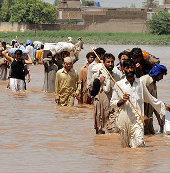
Physical damage averaged $ 1.6 billion per year (equal to 1.8% of GDP), nearly 80% of residents were affected and more than 3,100 died.
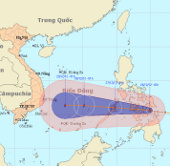
At 1 hour on December 26, the location of the center of the storm was about 10.6 degrees North latitude; 124.9 Kinh Dong, on the north of Min Da Nao Island (Philippines).
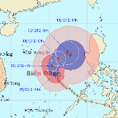
At 04:00 on December 7, the location of the center of the storm was about 13.4 degrees north latitude; 115.8 degrees Kinh Dong, about 550km from Hoang Sa archipelago to…
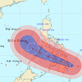
At 01:00 on December 4, the location of the center of the storm is about 7.6 degrees north latitude; 127.3 degrees east longitude, right on the east coast of Min island…