Environment
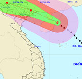
Thunderstorm storms straight into Quang Ninh
At 13 hours on July 18, the position of the center of the storm was about 19.9 degrees North latitude; 111.3 degrees Kinh Dong, about 420 km from Mong Cai (Quang Ninh) t…
Browse ScienceInfo articles and explainers related to PER.
374 published items.
At 13 hours on July 18, the position of the center of the storm was about 19.9 degrees North latitude; 111.3 degrees Kinh Dong, about 420 km from Mong Cai (Quang Ninh) t…

On May 26, the World Meteorological Agency (WMO) announced that the concentration of CO2 in the atmosphere has exceeded the new threshold.
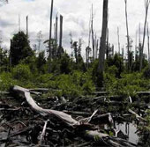
From 2005 up to now, the average forest area of Mexico has been reduced by 155,000 hectares per year. This North Central American country ranked 21st in the world in t…
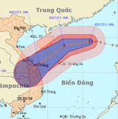
At 04:00 on November 2, the location of the center of the storm was about 19.4 degrees North latitude; 116.0 degrees Kinh Dong, about 510 km from Hoang Sa archipelago to…
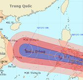
At 04:00 on November 7, the location of the storm center is about 8.4 degrees North; 133.6 Kinh Dong, about 780km from Min - Da - Nao Island (Philippines) to the East.
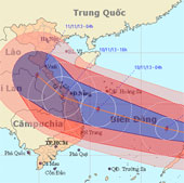
At 04:00 on November 8, the location of the center of the storm is about 10.8 degrees Vi Bac; 125.9 degrees east longitude, on the east coast of central Philippines
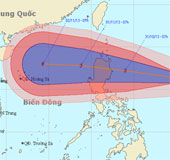
Currently, a storm is operating in the Eastern Philippines and has an international name of KROSA.
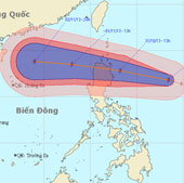
At 13:00 on October 30, the location of the center of the storm is about 16.8 degrees Vi Bac; 128.4 degrees Kinh Dong, about 670km from Lu-Dong Island (Philippines) to t…
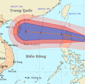
At 01:00 on October 31, the location of the center of the storm is about 17.5 degrees north latitude; 125.4 degrees Kinh Dong, about 340km from Lu-Dong Island (Philippin…
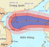
At 13 o'clock on October 31, the location of the center of the storm was about 18.0 degrees north latitude; 123.1 degrees east longitude, on the northeastern coast of Lu…
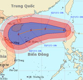
Early this morning (November 1), hurricane KROSA crossed Lu-Dong Island (Philippines) into the northeastern area of the East Sea - the storm No. 12.
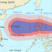
Currently, a storm is operating in the Eastern Philippines and has an international name as NARI.
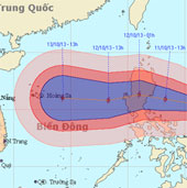
At 01:00 on October 11, the location of the storm center is about 15.3 degrees Vi Bac; 125.4 degrees Kinh Dong, about 400km from Lu-Dong Island (Philippines) to the East.

At 01:00 on October 12, the location of the center of the storm is about 15.6 degrees north latitude; 120.5 degrees east longitude, on the area of southwestern island…
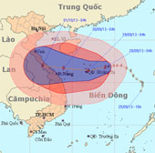
At 04:00 on September 28, the location of the storm center is about 16.8 degrees Vi Bac; 113.9 degrees Kinh Dong, about 180 km from Hoang Sa archipelago to the East.