Environment
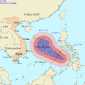
Super typhoon Bopha can affect Danang - Vung Tau
The strongest winds in the area near the storm center are strong at level 12 (ie, from 118 to 133 km per hour), shocking level 13, level 14.
Browse ScienceInfo articles and explainers related to PER.
374 published items.
The strongest winds in the area near the storm center are strong at level 12 (ie, from 118 to 133 km per hour), shocking level 13, level 14.
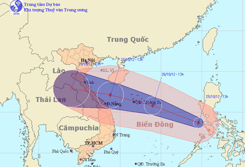
At noon today (October 25), Typhoon Son Tinh went into the East Sea and became the 8th storm to operate on this sea.
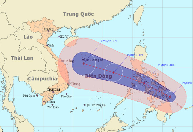
At 13:00 on October 24, the location of Son Tinh's storm center is about 10.4 degrees Vi Bac; 125.3 degrees Kinh Dong, on the northern area of Min Da Nao Island (Phili…
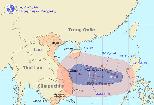
At 07:00 on October 3, the location of the center of the storm is about 15.3 degrees Vi Bac; 117.4 degrees Kinh Dong, about 570 km from Hoang Sa archipelago to the East…
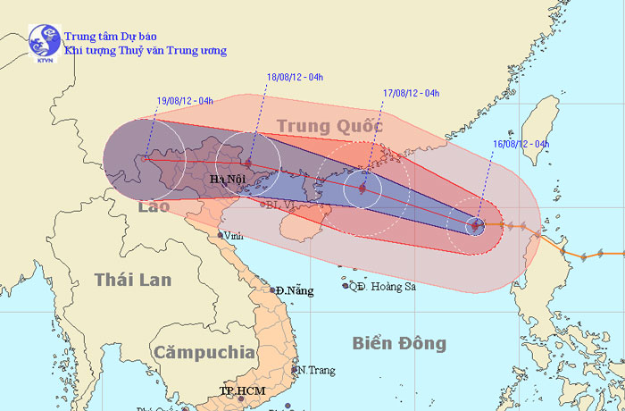
At 04:00 on August 16, the location of the center of the storm was about 19.1 degrees North latitude; 117.9 Kinh Dong, about 670km from Hoang Sa archipelago to the East…
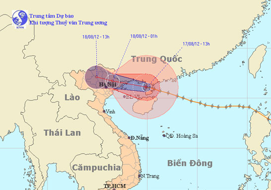
At 13:00 on August 17, the location of the center of the storm was about 21.1 degrees north latitude; 109.9 Kinh Dong, on the northwestern area of Leizhou Peninsula (C…
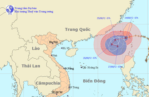
At 7 o'clock on August 24, the location of the center of the storm was about 22.2 degrees Vi Bac; 120.6 degrees Kinh Dong, on the southern island of Taiwan (China). The…
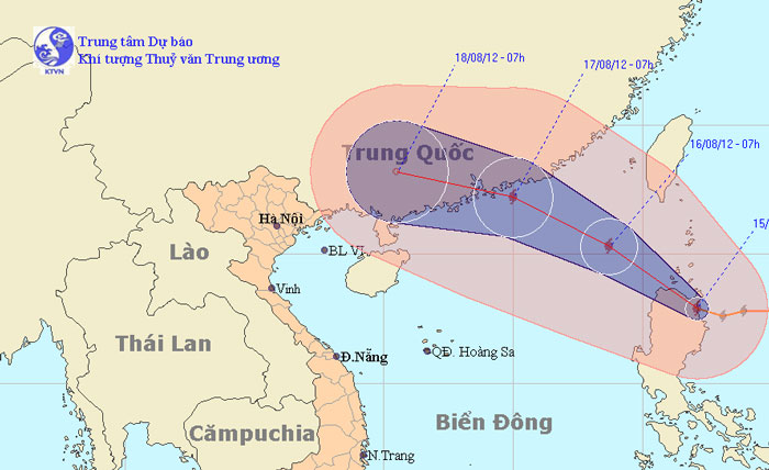
At 07:00 on August 15, the location of the center of the storm was about 17.9 degrees Vi Bac; 122.1 degrees Kinh Dong, on the northern area of Lu - Dong Island (Philip…
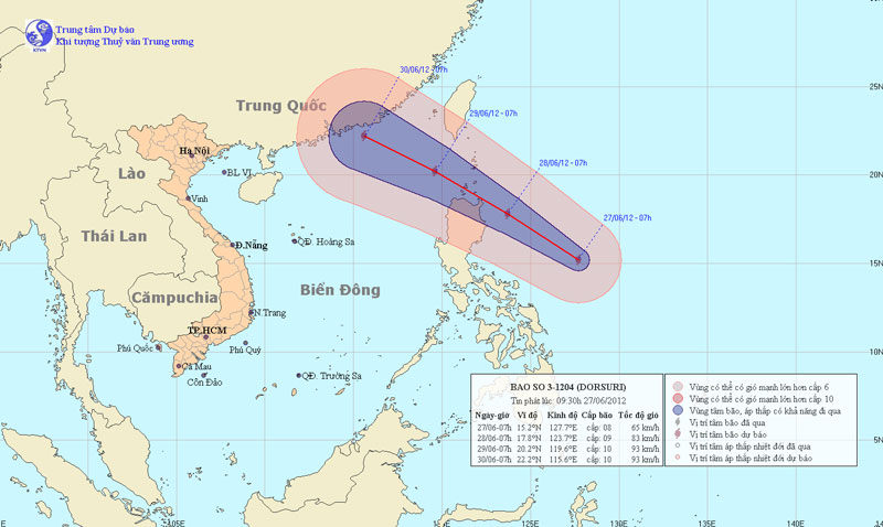
Currently, in the East Sea of Luong Island (Philippines) a storm is active and the international name is Doksuri. At 7 am on June 27, the location of the center of the…
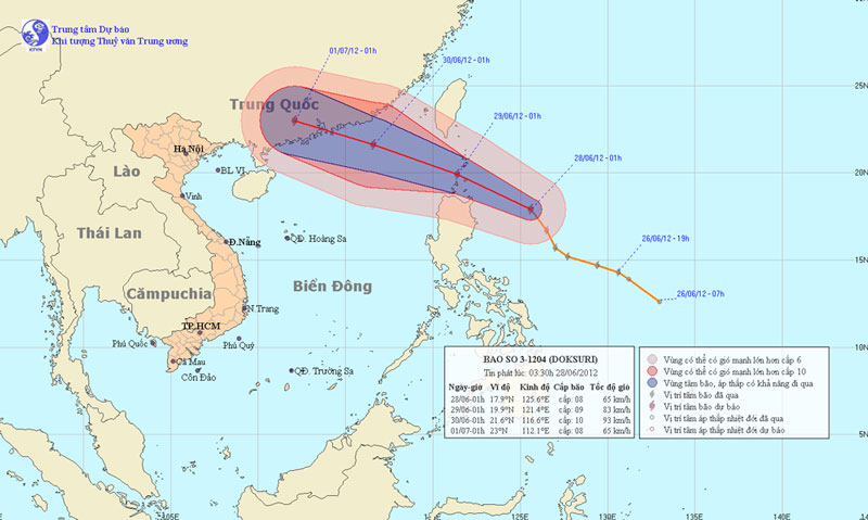
At 01:00 on June 28, the location of the storm center is about 17.9 degrees North latitude; 125.6 Kinh Dong, about 380km from Lu-Dong Island (Philippines) to the East. T…
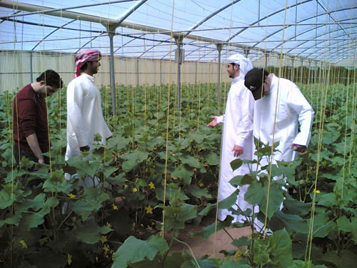
Oil has turned Qatar into a rich country with the highest per capita income in the world, but it still cannot afford food self-sufficiency.
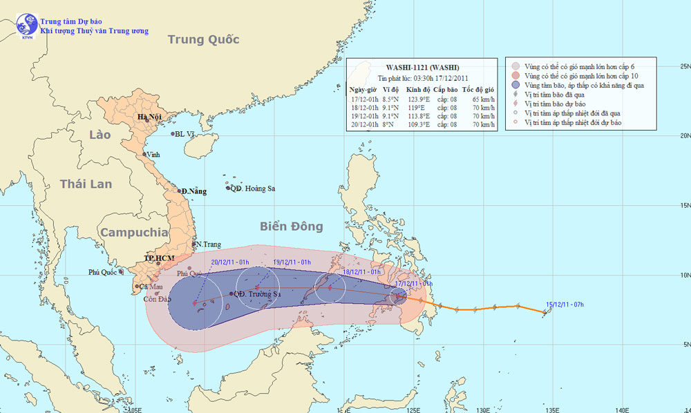
At 01:00 on December 17, the location of the center of the storm is about 8.5 degrees North Latitude; 123.9 degrees Kinh Dong, in the southern Philippines. The strongest…
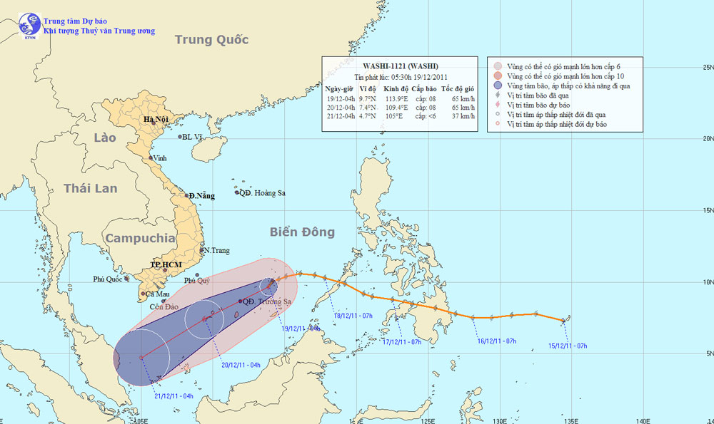
At 04:00 on December 19, the location of the center of the storm was about 9.7 degrees Vi Bac; 113.9 degrees east longitude, about 250 km away from Truong Sa archipelago…
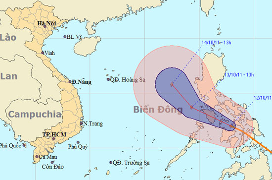
Currently, in the region of the Central Islands of the Philippines there is an active storm with the international name of BANYAN.
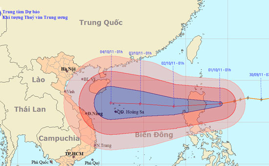
At 1 o'clock on October 1, the location of the center of the storm is about 17.2 degrees Vi Bac; 124.1 degrees east longitude, about 200km from the island of Luke (Phili…