
Environment
Hurricane Harvey forced NASA to close the space center
The US Space and Space Center's Johnson (JSC) is being closed when complicated flooding in the Houston city by Tropical Storm Harvey causes heavy rain.
Browse ScienceInfo articles and explainers related to Super Typhoon.
198 published items.
The US Space and Space Center's Johnson (JSC) is being closed when complicated flooding in the Houston city by Tropical Storm Harvey causes heavy rain.

Witnessing the destructive power of super typhoons, many scientists in history have come up with ideas to counter this extreme weather phenomenon.
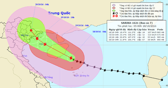
At 04:00 on October 18, the location of the center of the storm was about 18.4 degrees north latitude; 111.3 Kinh Dong, about 190km from Hoang Sa archipelago to the Nort…
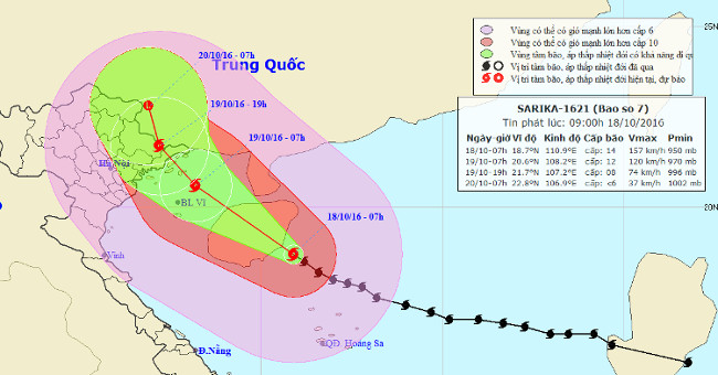
At 07:00 on October 18, the location of the center of the storm was about 18.7 degrees Vi Bac; 110.9 degrees Kinh Dong, on the southeastern coast of Hainan Island (China…
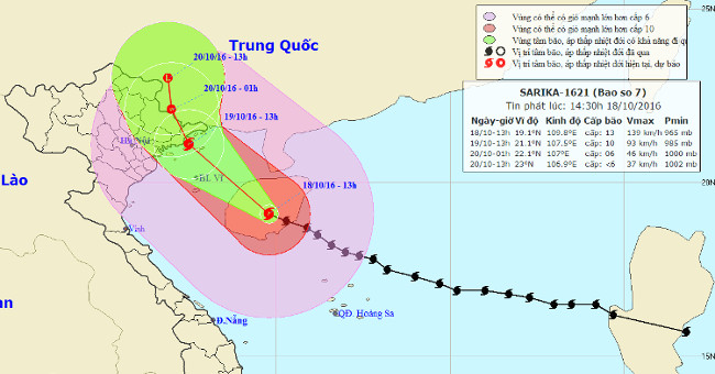
Due to the influence of the storm circulation No. 7, at 13:00 on October 18 at Bach Long Vi island station, it was able to measure strong level 8 wind, level 10 shock; C…
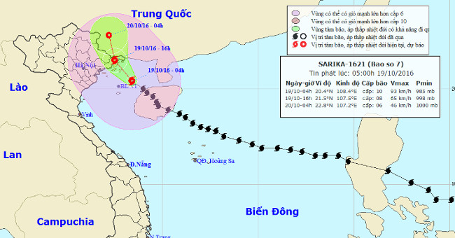
Due to the influence of storm circulation number 7, to 04 hours on October 19 at Bach Long Vi island station, it is possible to measure strong winds of level 9, shock le…
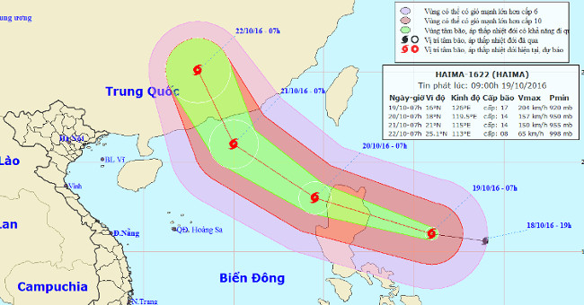
At 07:00 on October 19, the location of the center of the storm was about 16.0 degrees north latitude; 126.0 degrees Kinh Dong, about 440 km from Lu Dong Island to the E…
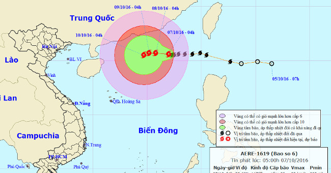
At 4 o'clock, the location of the storm center is about 20.6 degrees North latitude; 117.0 degrees Kinh Dong, in the Northeast of the East Sea, about 720km from Hoang Sa…
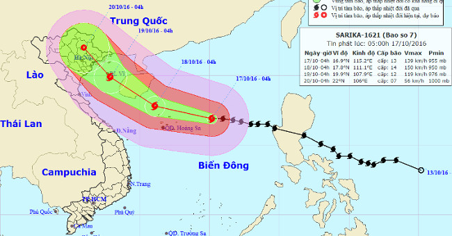
At 04:00 on October 17, the position of the center of the storm was about 16.9 degrees Vi Bac; 115.2 degrees Kinh Dong, about 320km from Hoang Sa archipelago to the East.
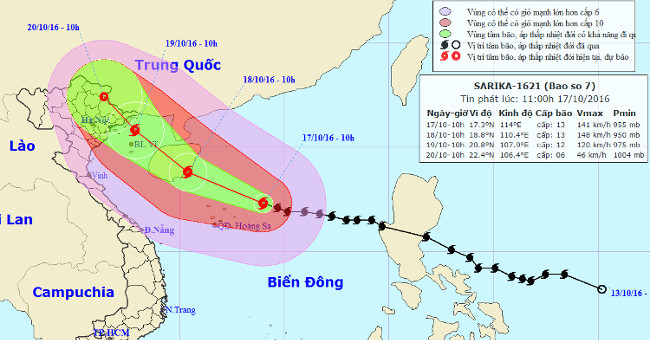
At 10 o'clock on October 17, the location of the center of the storm is about 17.3 degrees Vi Bac; 114.0 degrees Kinh Dong, about 220 km from Hoang Sa archipelago to the…

Typhoon Sarika is about 220km from the Paracel Islands, another newly formed storm is also heading towards the East Sea.
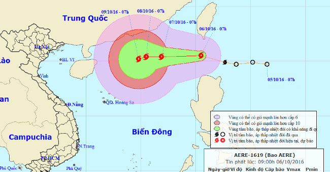
In the early morning of October 6, the tropical depression intensified into a storm, the name of which was called Aere. The strongest wind in the area near the storm cen…

The online community is sharing satellite images of the storm
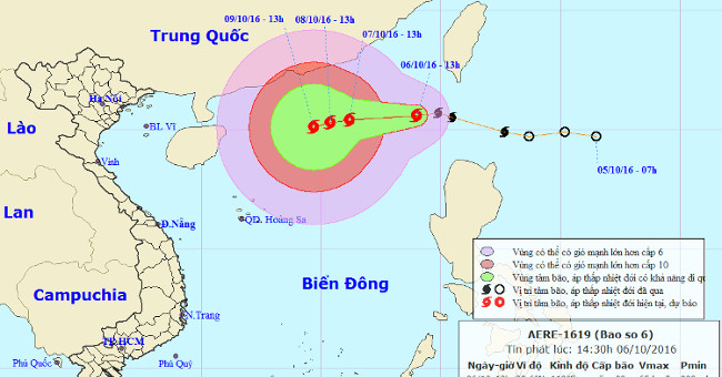
At 13 o'clock, the location of the center of the storm was about 20.6 degrees north latitude; 119.0 degrees east longitude, on the northeastern region of the East Sea. T…
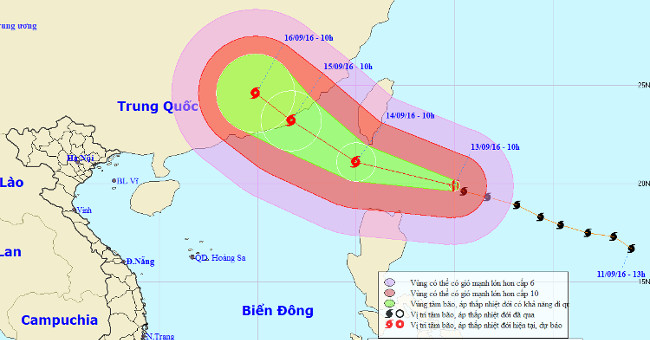
Typhoon No. 4 has just poured into the Central region, the new super typhoon named Meranti, strong at level 17 (200-220km / hour), jerking at level 17. Again heading to…