Environment
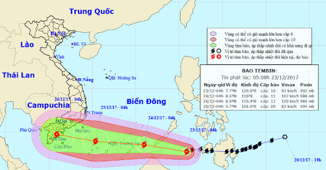
Tembin stormed up and landed in our country tonight
This morning, Typhoon Tembin is still strong at level 9, level 12 in the southwestern Philippines, then moving in the West with the speed of 20km / h.
Browse ScienceInfo articles and explainers related to Area.
4,758 published items.
This morning, Typhoon Tembin is still strong at level 9, level 12 in the southwestern Philippines, then moving in the West with the speed of 20km / h.

According to the government, the number of fatal victims concentrated in Lanao del Norte, Zamboanga del Norte and Lanao del Sur areas and increased the most in the night…
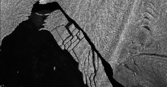
Icebergs are more than four times the size of New York's Manhattan area separated from the Pine Island and Antarctic glaciers two months ago, breaking into small pieces,…
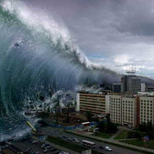
What causes earthquakes and earthquakes to be the only cause of tsunami? Is it possible to predict when this happens as well as to prevent these phenomena?

American scientists have drawn the deepest area map in the ocean, more detailed than the previous maps. It is the Mariana basin in the western Pacific Ocean, about 2500k…
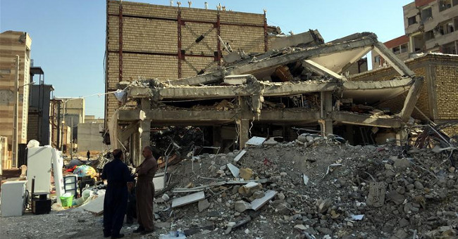
The magnitude 6 earthquake struck on December 1 in southeastern Iran, injuring at least 42 people and damaging many homes in the area.
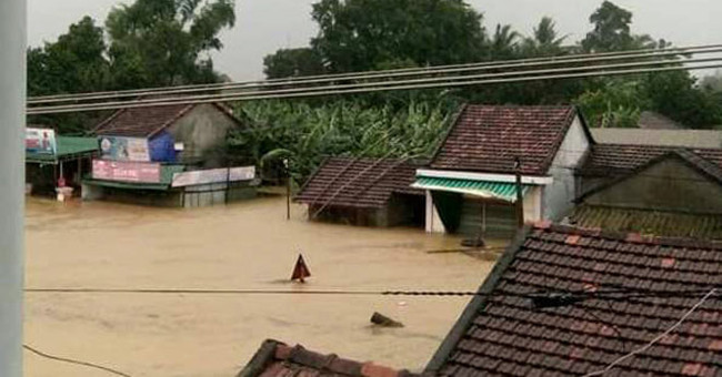
Today, November 6, floods in the central region continue to rise rapidly, on par with the previous record, many areas suffered serious flooding.
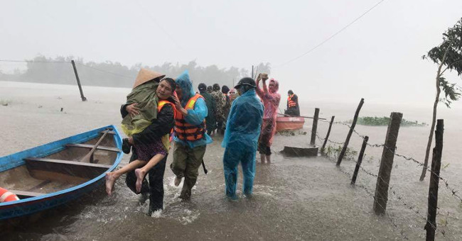
Currently, in the Gulf of Thailand, there is an area of low pressure located at 1 am early this morning, about 8.2-9.2 degrees north latitude, 101.5-102.5 degrees east…
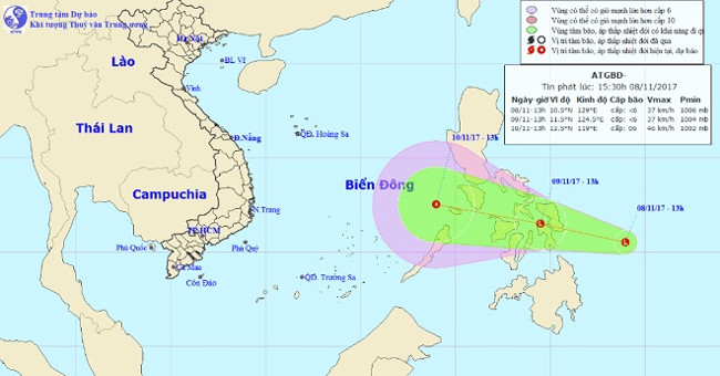
It is forecasted that within 24 hours, this low pressure area will move in the West-Northwest direction, about 20km per hour and there will be a strong possibility.

In the evening, the tropical depression intensified into a storm with the international name Haikui, this is the number 13 storm in the East Sea.
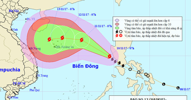
In the early morning of November 10, Haikui storm entered the South China Sea and became the No. 13 storm in the South China Sea during the year. The direction of the st…
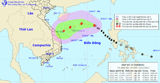
At 4:00 am on 11/11, the location of the center of the storm is about 17.4 degrees north latitude; 116.5 degrees Kinh Dong is about 540 km from Hoang Sa archipelago to t…
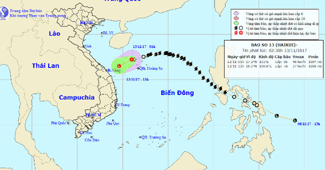
At 01:00 on November 13, the position of the tropical depression center was about 17.2 degrees North latitude; 111.0 degrees east longitude, right on the sea in the nort…
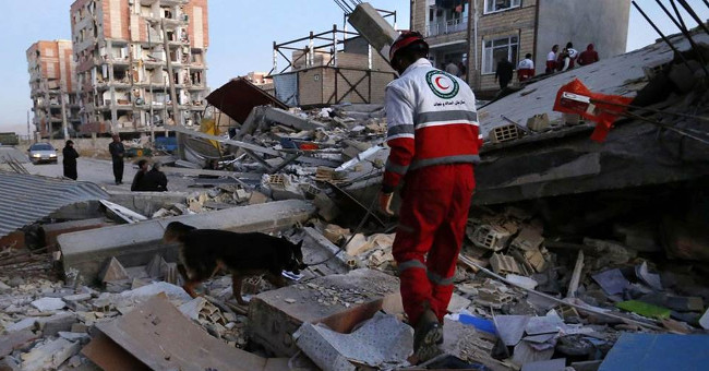
The latest information by Iranian National Television on November 13 provides that casualties in the earthquake disaster in the border region between Iran and Iraq have…
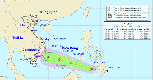
At 01:00 on November 17, the position of the tropical depression center was about 7.4 degrees North; 122.5 degrees east longitude, about 470 km from Palawan (Philippines…