Environment
Actively prevent storm Kai-Tak
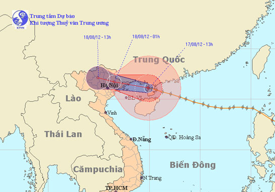
At 13:00 on August 17, the location of the center of the storm was about 21.1 degrees north latitude; 109.9 Kinh Dong, on the northwestern area of Leizhou Peninsula (C…
Browse ScienceInfo articles and explainers related to Latitude.
135 published items.
At 13:00 on August 17, the location of the center of the storm was about 21.1 degrees north latitude; 109.9 Kinh Dong, on the northwestern area of Leizhou Peninsula (C…
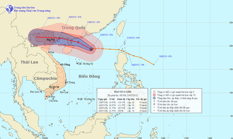
At 07:00 on July 23, the location of the center of the storm was about 19.4 degrees north latitude; 114.5 degrees Kinh Dong, 390 km from Hoang Sa archipelago to the Nort…
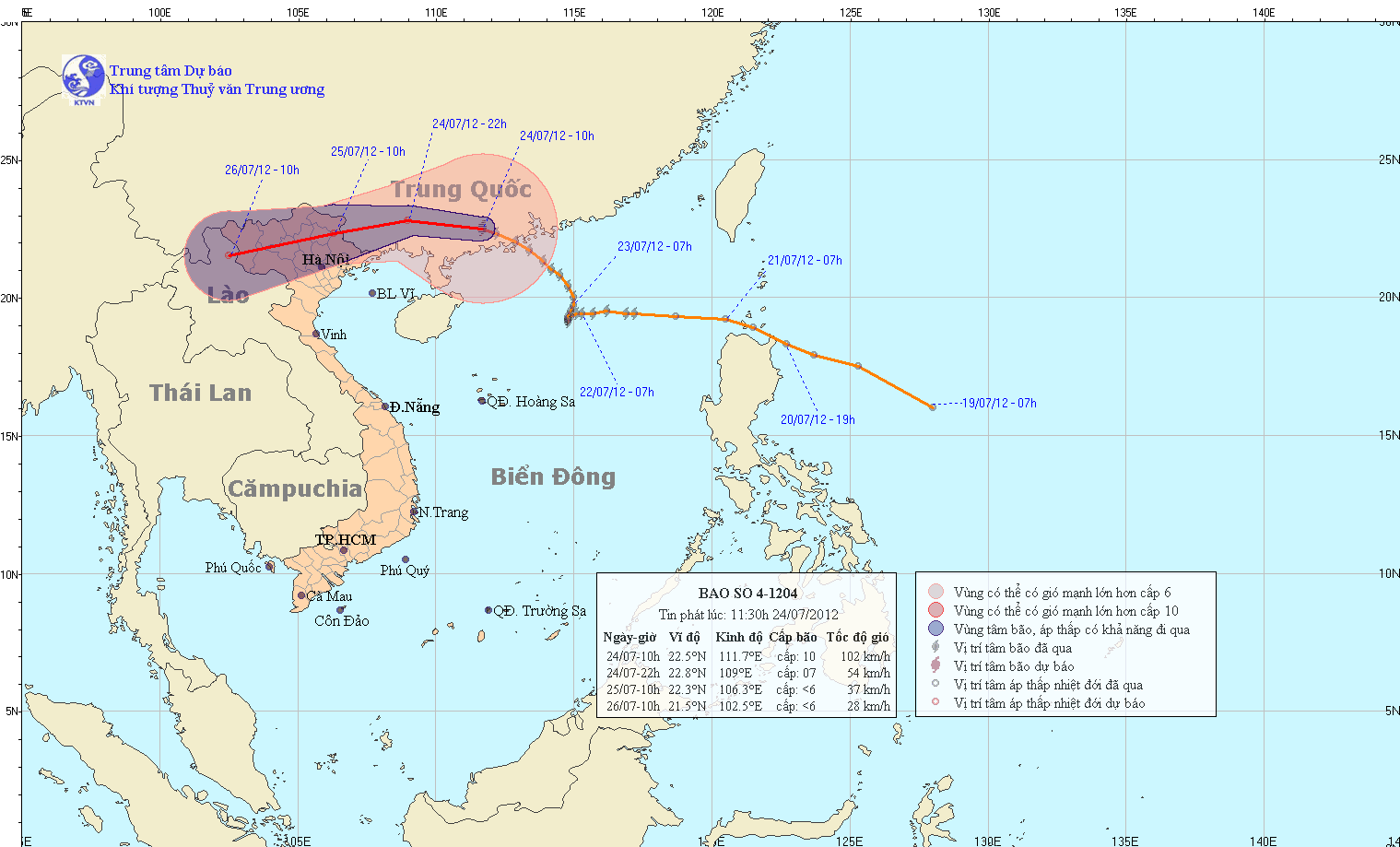
At 10 am on July 24, the location of the center of the storm is about 22.5 degrees north latitude; 111.7 degrees Kinh Dong, about 400 km from Mong Cai (Quang Ninh) to th…
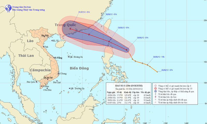
At 01:00 on June 28, the location of the storm center is about 17.9 degrees North latitude; 125.6 Kinh Dong, about 380km from Lu-Dong Island (Philippines) to the East. T…
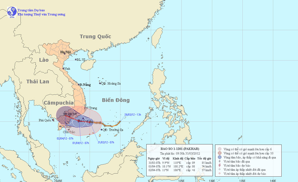
At 7 o'clock on March 31, the position of the center of the storm was about 9.9 degrees north latitude; 110.0 degrees Kinh Dong, about 130km from Phu Quy island to the E…
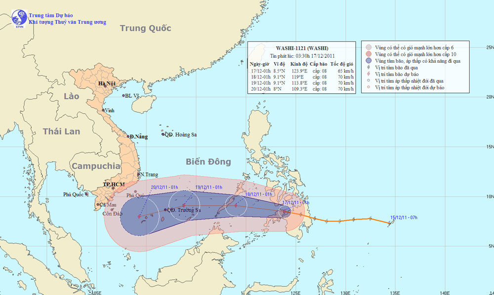
At 01:00 on December 17, the location of the center of the storm is about 8.5 degrees North Latitude; 123.9 degrees Kinh Dong, in the southern Philippines. The strongest…
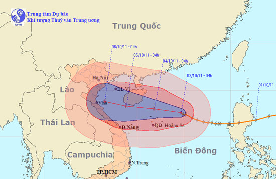
At 04:00 on October 3, the location of the center of the storm was about 17.6 degrees north latitude; 114.7 degrees Kinh Dong, about 250 km from Hoang Sa archipelago to…
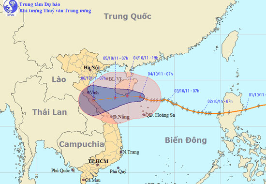
At 07:00 on October 4, the location of the center of the storm was about 18.2 degrees north latitude; 111.3 Kinh Dong, about 400km from the coast of Thua Thien Hue - Da…
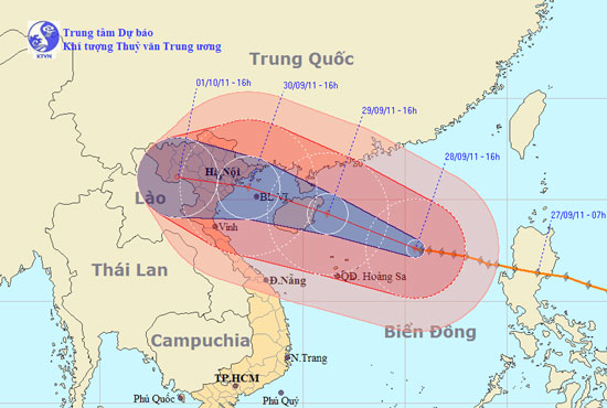
At 16:00 on September 28, the location of the center of the storm was about 17.6 degrees north latitude; 115.5 degrees east longitude, about 350 km from Hoang Sa archipe…
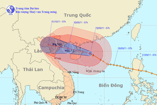
At 07:00 on September 29, the location of the center of the storm was about 19.6 degrees North latitude; 112.3 degrees Kinh Dong, about 620km from the coast of Quang Nin…
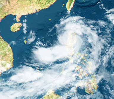
At 10 o'clock on July 29, the location of the center of the storm was about 18.5 degrees north latitude; 112.3 degrees Kinh Dong, about 170 km from Hoang Sa archipelago…

At 16 o'clock on July 29, the location of the center of the storm was about 19.2 degrees north latitude; 111.1 degrees east longitude, about 580km from Thai Binh - Ha Ti…
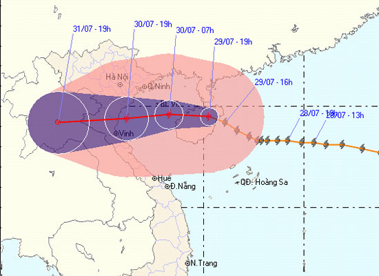
At 19:00 on July 29, the location of the center of the storm was about 19.5 degrees North latitude; 110.3 degrees Kinh Dong, about 490 km away from the coast of Thai Bin…
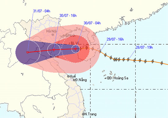
At 04:00 on July 30, the location of the center of the storm was about 19.5 degrees North latitude; 108.4 degrees Kinh Dong, about 290km from the coast of Thai Binh - Ha…
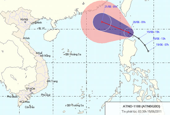
At 1 hour on June 20, the position of the tropical depression center is about 19.5 degrees North latitude; 121.3 Kinh Dong, about 90 km from Lu - Dong Island (Philippine…