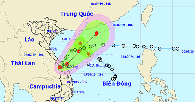
EnvironmentTropical Depression (tropical depression), known internationally as Kajiki, continues to move to the northeast and could become a typhoon in the next three days.
September 4, 2019
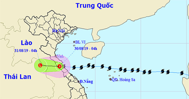
EnvironmentThis morning (August 30), after moving to the mainland of Ha Tinh and Quang Binh provinces, typhoon No. 4 weakened into a tropical depression.
August 31, 2019
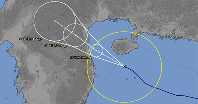
EnvironmentPodul typhoon strengthened to level 9 with winds of 90 km / h, making it possible to land in Nghe An, Ha Tinh and Quang Binh provinces at 4-8am on August 30.
August 29, 2019
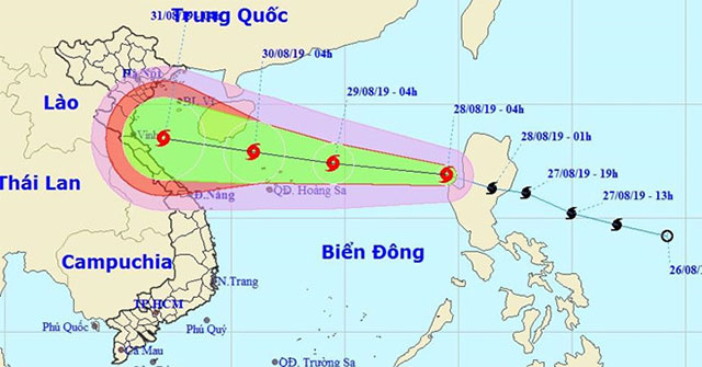
EnvironmentPodul moved quickly and entered the South China Sea early on August 28. It is predicted that the storm will continue to strengthen and possibly enter the Tonkin Gulf in…
August 28, 2019
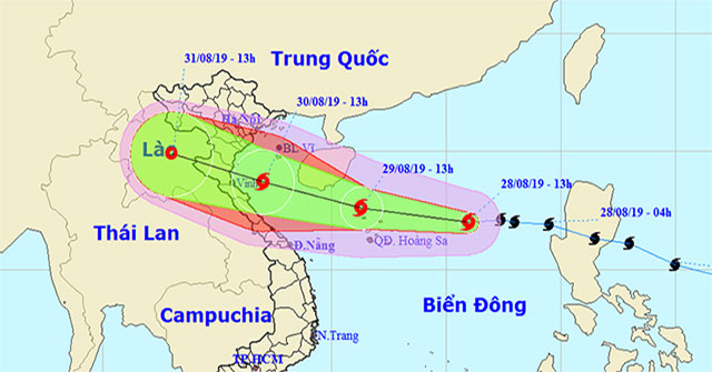
EnvironmentAt 13:00 on August 28, the location of the storm center was about 17.0 degrees North; 116.0 degrees east, about 450km to the east of the Paracel Islands.
August 28, 2019
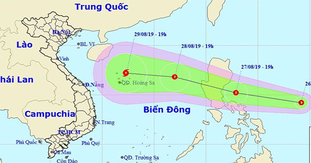
EnvironmentTropical depressions near the South China Sea are forecast to be able to become storms and enter the South China Sea region around August 28-29.
August 27, 2019
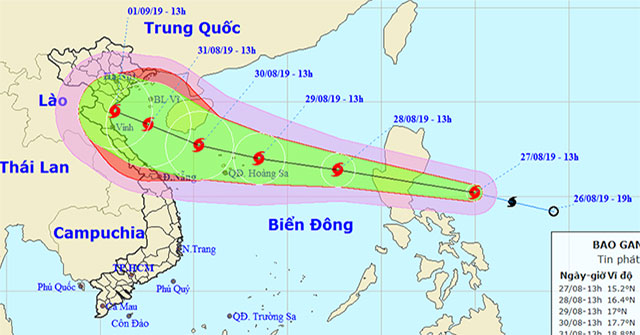
EnvironmentAccording to the Central Hydrometeorology Center, this morning, August 27, the tropical low pressure in the eastern central region of the Philippines became a strong sto…
August 27, 2019
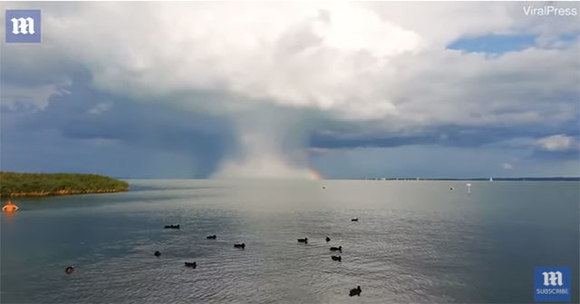
EnvironmentIntense rain bombs appear along the rainbow in Balaton, Central Europe's largest freshwater lake in Veszprem County, Hungary, on August 16.
August 21, 2019

Discover scienceWe know that wind is the movement of air flow, formed by the change of atmospheric pressure, often going from a place of high pressure to low pressure.
August 16, 2019
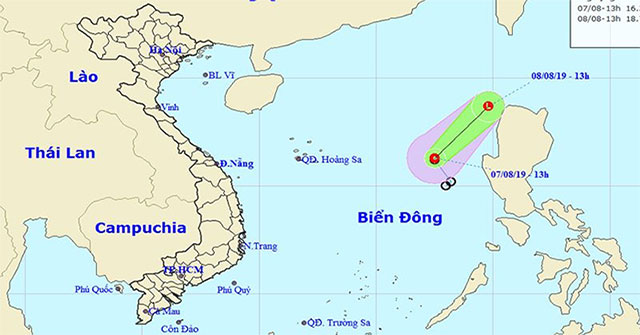
EnvironmentTonight and tomorrow, the waters from Binh Thuan to Kien Giang, the Gulf of Thailand, the South China Sea region have showers and thunderstorms.
August 7, 2019
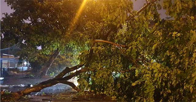
EnvironmentNorthern Quang Ninh landfall caused heavy rains and winds, and on August 3, Wipha stormed into a tropical depression, continuing to influence Hai Phong and Nam Dinh.
August 3, 2019
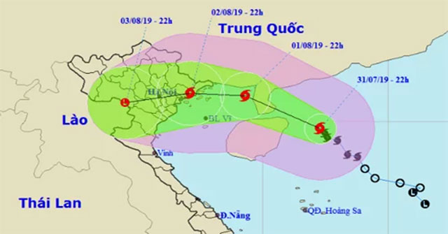
EnvironmentAt 0:00 on August 1, Hurricane Wipha with winds of 90km / h is only 120km from the Gulf of Tonkin, forecast to cause heavy rain for the North East from this afternoon.
August 1, 2019
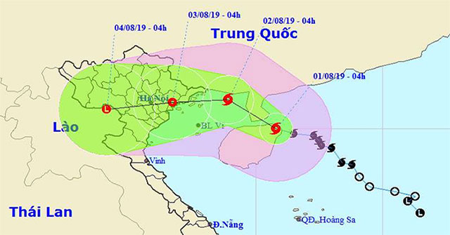
EnvironmentIn the past 3 hours, the storm No. 3 moved mainly in the North direction.
August 1, 2019
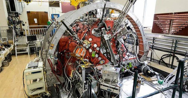
Space scienceThe plasma sphere at the University of Wisconsin-Madison is being used to better study our Sun.
July 31, 2019
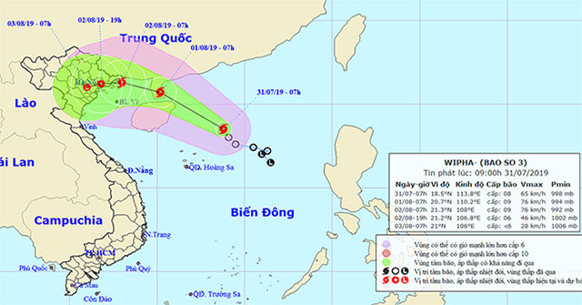
EnvironmentThis morning (July 31), the tropical low pressure on the North East Sea became strong into a storm (storm No. 3 in 2019) and the international name is WIPHA.
July 31, 2019