Twin-minded storms on the Pacific Ocean from the universe
Astronauts on the ISS space station and weather satellite have taken many photos of two parallel storms in the Pacific Northwest.
Extremely rare twin storms appear in the Pacific Ocean
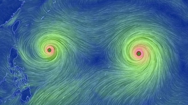
Satellite image showing the wind direction of two storms Goni (left) and Atsani (right).Goni and Atsani appear quite close together.Typhoon Goni is expected to land in the vicinity of Taiwan and the Philippines this week while Typhoon Atsani faces Japan.As predicted, the wind near the center of the storm reached 240 km / h, Mashable reported.
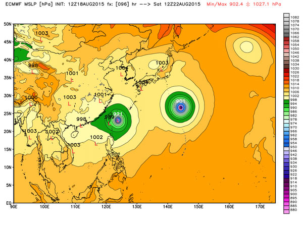
Satellite images show that Typhoon Atsani is large and fierce but farther away from the mainland than Goni.
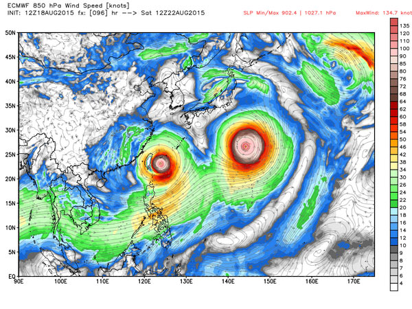
According to the forecast, Goni center will come near Taiwan on August 23.It landed just two weeks after Soudelor, the strongest tropical storm of 2015, swept across the island and landed in mainland China.Meanwhile, Typhoon Atsani is getting stronger and stronger, but its direction cannot be ascertained.
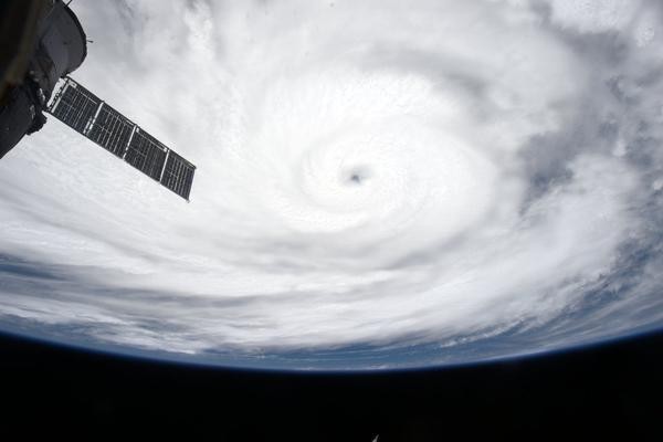
Storm Atsani looks from the International Space Station ISS.
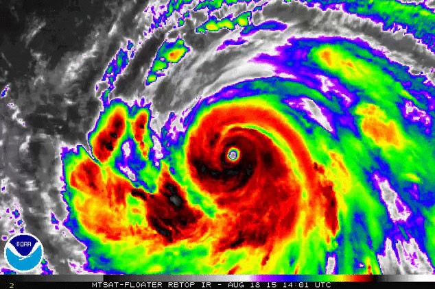
Weather satellite of the National Oceanic and Atmospheric Administration (NOAA) photographed storm Atsani on August 18.

Suomi weather satellite of the US Aerospace Agency (NASA) photographed Goni storm.
- Three extremely rare tropical storms occur simultaneously on the Pacific Ocean
- Why don't planes often fly across the Pacific Ocean?
- Big storms appear in Central America and the Caribbean
- How are Pacific storms named?
- The twin twin stars are very different
- Discovered a huge gold store at the bottom of the Pacific Ocean
- Three storms converge in northeastern East Sea
- Red spots warn of the coming flood and rain!
- NASA 'twin ship' celebrates its 5th birthday
- French athletes swim 8,850km across the Pacific
- Pacific: islands are threatened by storms.
- Video: How deep is the ocean?
 Is the magnetic North Pole shift dangerous to humanity?
 Washington legalizes the recycling of human bodies into fertilizer
 Lightning stone - the mysterious guest
 Stunned by the mysterious sunset, strange appearance