Typhoon Ha Long may soon enter the East Sea
A storm named Ha Long and another tropical depression have just formed in the eastern Philippines.

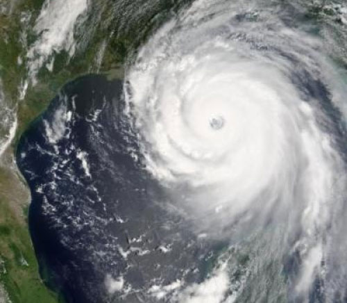
Illustration
According to information from the Central Center for Hydrometeorological Forecasting and major meteorological stations in the Asia-Pacific region, currently in the East of the Philippines there is a storm with the international name Halong (Ha Long) and another tropical depression recently formed near the east of Luzon Island - Philippines.
Halong is heading towards the West Northwest, while the low pressure is moving in the West.
At present, the weather in the Southern and Southern regions is developing with bad form and heavy rain.
The Central Center for Hydrometeorological Forecasting said that, due to the influence of tropical convergence band with axes of about 18-18 degrees north latitude and southwest wind zone, the area between the South and South East Sea (including including the waters of the Spratly Islands; showers and strong thunderstorms from Binh Thuan to Ca Mau; Strong southwest wind level 5, sometimes level 6, level 7, level 8, rough sea.
- On December 10, Typhoon Utor will enter the East Sea
- Typhoon Yutu is level 16, entering the South China Sea tonight
- Haima storm causes level 16 wind to enter the South China Sea
- In the next 24 hours, the mind of the super typhoon Haiyan enters the waters of Hue-Binh Dinh
- This afternoon, Typhoon Kai-Tak will land in the East Sea
- This afternoon, super typhoon Mangkhut is more likely to enter the East Sea
- Super typhoon Yutu jerked on level 17, very near the East Sea
- Typhoon Krosa threatens the Central
- Bebinca storms are getting stronger in the South China Sea
- The typhoon Nanmadol indirectly caused the male to rain a lot
- Typhoon Tembin will cause waves as high as 9 meters into our country
- Son Tinh storm level up, entering the East Sea
 Is the magnetic North Pole shift dangerous to humanity?
 Washington legalizes the recycling of human bodies into fertilizer
 Lightning stone - the mysterious guest
 Stunned by the mysterious sunset, strange appearance
 Super typhoon Manyi enters the East Sea, cold air moves slowly
  Storm No. 9 Manyi, level 12, about 200km from Hoang Sa archipelago
  Storm Tra Mi enters the East Sea today, strange movement direction
  The Da River fault zone causes earthquakes in Ninh Binh
  Sea levels are rising rapidly due to El Nino and climate change
  Tropical depressions appear into the East Sea, likely to become a typhoon