Depression in Ha Tinh-Quang Binh, causing heavy rain
Dawn of October 10, Tropical Depression has entered the mainland with the highest level 6 winds (40-50 km per hour), level 8 jerks.
According to the Central Hydrometeorological Center, at 4:00 on October 10, the position of the tropical low pressure center on the mainland of Ha Tinh and Quang Binh provinces.
Due to the influence of low pressure circulation, on Hon Ngu island (Nghe An), there is strong wind level 7, level 9 jerk, in Ky Anh (Ha Tinh), Ba Don (Quang Binh) with wind level 7, Con Co island (Quang Tri) at level 9, Ly Son island (Quang Ngai) is level 8.
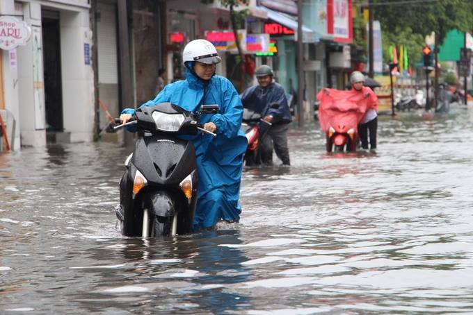
Low pressure circulation causes heavy rain in many areas, many streets in Hue were flooded on October 9.(Artwork: Vo Thanh).
The Northern Delta region and the provinces from Thanh Hoa to Quang Ngai during the day and last night had heavy rain, some places with very heavy rain like Vinh 124mm City, Ha Tinh City 242 mm, Huong Son District (Ha Tinh) 205mm, Tuyen Hoa district (Quang Binh) 237mm, Nam Dong district (Thua Thien Hue) 139mm .
Forecast in the next 12 hours, low pressure will move in the direction of West-West, about 25km per hour, going deep into Nghe An-Quang Binh provinces, then weakening into a low pressure area in Upper Lao area. The strongest wind in the center of the low pressure area falls below level 6 (below 40km / hour).
Today, October 10, due to the influence of depressions, the Northern Gulf of Tonkin, the waters from Thanh Hoa to Quang Tri (including Con Co and Hon Ngu islands) also have strong winds of level 6, level 8 shock. 2-4m high sea waves, coastal provinces of Nghe An, Quang Binh, strong winds of level 6, shock level 8; The provinces of Thanh Hoa and Quang Tri province have level 8 winds.
In the provinces from Thanh Hoa to Quang Tri, there is a heavy rain, with a rainfall of 100-200mm, a place of over 250mm, areas in the South of the Northern Delta, Hoa Binh, Phu Tho, Yen Bai and Nam Son La with moderate rainfall , heavy rain 70-150 mm, there are places above 200mm.
Meteorological agencies also warned of high risks of flash floods, landslides in mountainous areas, local flooding in low-lying areas in provinces from Thanh Hoa to Quang Ngai.
The low pressure area was formed from October 7 and entered the South China Sea one day later. In the first two days, the strongest level of the depression was only level 6. But from the morning of October 9, when entering the low-pressure Truong Sa archipelago area, forming vortices, strong up to level 7.
- Low pressure to become a storm, landed in Ha Tinh - Quang Binh
- This evening, the tropical depression landed in Quang Binh - Da Nang
- Flooding in the roof of Quang Binh
- This evening, the tropical depression landed in Quang Binh - Da Nang
- Quang Binh has a big power outage, and Ha Tinh has lost its telecommunication waves
- Many Quang Binh people eat white rice, shrimp noodles live on the roof
- Podul storm landed in Quang Binh
- Low pressure to become a storm, landed in Ha Tinh - Quang Binh
- The Storm of the Mountain Is Focusing on Central
- Storm No. 7 is complicated, causing widespread rain
- This afternoon, low pressure went to Quang Ninh - Hai Phong provinces
- Central Vietnam buried in the flood
- This afternoon and evening, the storm No. 4 will land in Ha Tinh - Quang Binh
- Tropical depressions to the shore, the North heavy rain
 Is the magnetic North Pole shift dangerous to humanity?
 Washington legalizes the recycling of human bodies into fertilizer
 Lightning stone - the mysterious guest
 Stunned by the mysterious sunset, strange appearance