
Environment
Hurricane number 2 - level 9 - 10 directed at Thanh Hoa to Ha Tinh
The Center for Hydro-meteorological Forecasting said that on the afternoon of July 15, the tropical low pressure on the Hoang Sa archipelago has become a storm, becoming…
Browse ScienceInfo articles and explainers related to Typhoon.
541 published items.
The Center for Hydro-meteorological Forecasting said that on the afternoon of July 15, the tropical low pressure on the Hoang Sa archipelago has become a storm, becoming…
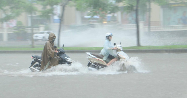
Due to the impact of typhoon 2, a long heavy rain caused many roads and streets in the Capital to be deeply submerged in the water.
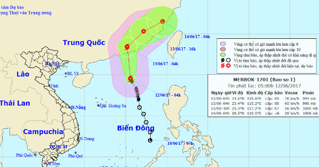
At 04 hours (June 12), the location of the center of the storm is about 19.5 degrees north latitude; 115.6 degrees east longitude, about 350km from Hong Kong (China) to…

Mr. Le Thanh Hai, Deputy General Director of the National Center for Hydrometeorology said, it is expected that the hot weather this year will be more severe, more likel…
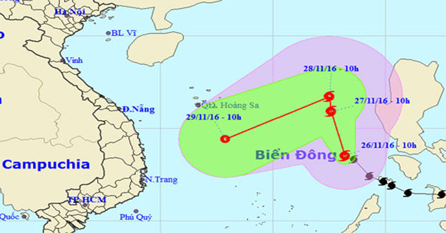
This morning typhoon Tokage entered the South China Sea and became the No. 9 storm of the year, it is forecasted to head to the southern region of Vietnam.
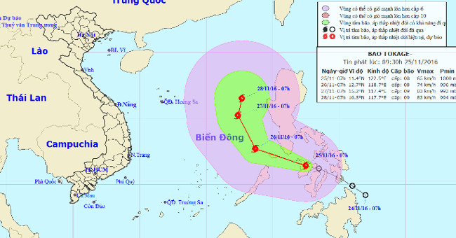
This morning (November 25), the tropical depression strengthened into a storm and the international name was Tokage.
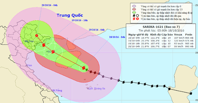
At 04:00 on October 18, the location of the center of the storm was about 18.4 degrees north latitude; 111.3 Kinh Dong, about 190km from Hoang Sa archipelago to the Nort…
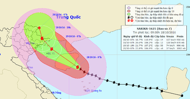
At 07:00 on October 18, the location of the center of the storm was about 18.7 degrees Vi Bac; 110.9 degrees Kinh Dong, on the southeastern coast of Hainan Island (China…
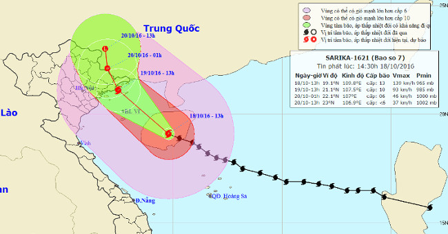
Due to the influence of the storm circulation No. 7, at 13:00 on October 18 at Bach Long Vi island station, it was able to measure strong level 8 wind, level 10 shock; C…
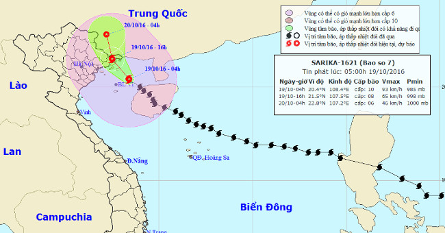
Due to the influence of storm circulation number 7, to 04 hours on October 19 at Bach Long Vi island station, it is possible to measure strong winds of level 9, shock le…
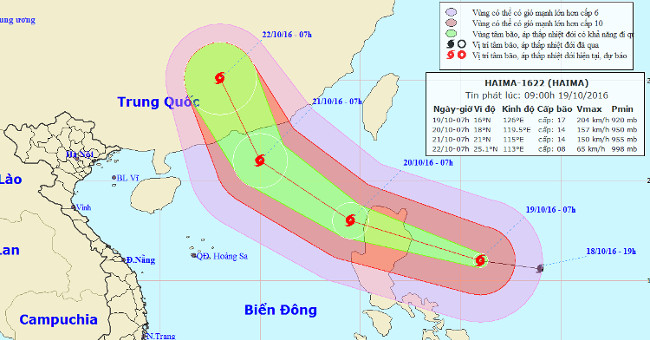
At 07:00 on October 19, the location of the center of the storm was about 16.0 degrees north latitude; 126.0 degrees Kinh Dong, about 440 km from Lu Dong Island to the E…
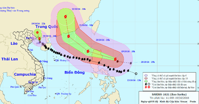
At 10 am on October 19, after approaching the Quang Ninh sea, Sarika stormed into a tropical depression, but still caused a gust of 8-9 winds.
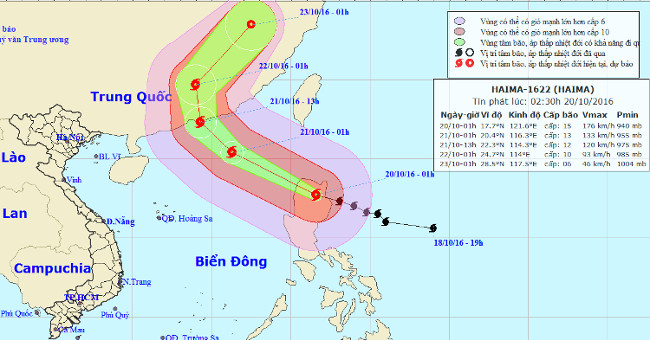
At 01:00 on October 20, the location of the storm center is about 17.7 degrees Vi Bac; 121.6 degrees Kinh Dong, on land north of Lu Dong Island (Philippines).
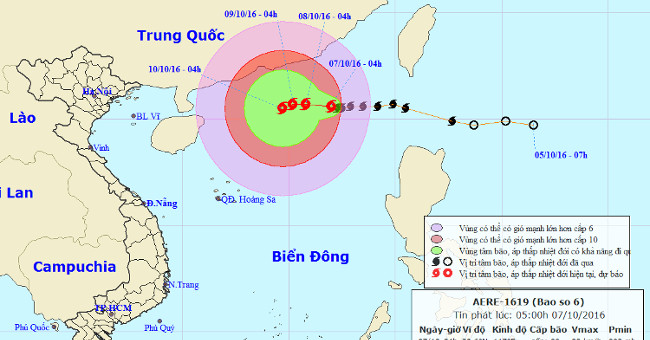
At 4 o'clock, the location of the storm center is about 20.6 degrees North latitude; 117.0 degrees Kinh Dong, in the Northeast of the East Sea, about 720km from Hoang Sa…
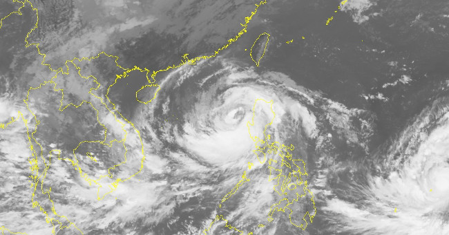
At 8:00 on October 16, Typhoon Sarika crossed Luzon Island (Philippines) into the South China Sea with maximum winds of 165 km / h (level 14), 2 levels higher than last…