According to experts, terrain, slope, geology, and the effects of climate change with heavy rains after storms are the causes of flash floods and landslides in mountainous

Spain has suffered heavy losses after the worst flash floods in its history.

The flash floods that killed at least 95 people in the Valencia region in 1996 were the result of climate change, post-summer dry soil and cold drops.

Behind the magnificence of the big cloud like this river are unpredictable hazards.

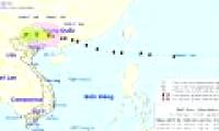
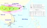
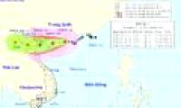
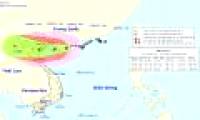
It is forecasted that in the next 6 hours, the storm will continue to move quickly in the direction of West-West Northwest, 25km per hour, going deep into the mainland of Guangxi

This month, typhoons and tropical depressions are capable of operating in the South China Sea about 1-2 times and about 1 attack affects the mainland.

From 7 hours on 11/7 to 1 hour on July 12, the northern provinces have had heavy rain and rain, some places with big to big rains like Pho Rang (Lao Cai) 49mm, Yen Bai 168mm, ...

Early this morning, the storm No. 3 began to accelerate and tended to strengthen. It is expected that tomorrow morning, the storm will reach the mainland with strong winds of

At 14:00 on August 18, the location of the storm center number 3 is about 21.0 degrees North latitude; 110.8 degrees Kinh Dong, on the sea to the east of Loi Chau Peninsula

The lightning god storm is moving, about 15-20 km every hour, going into the northern Gulf of Tonkin waters and will continue to grow stronger.
 According to experts, terrain, slope, geology, and the effects of climate change with heavy rains after storms are the causes of flash floods and landslides in mountainous
 Spain has suffered heavy losses after the worst flash floods in its history.
 The flash floods that killed at least 95 people in the Valencia region in 1996 were the result of climate change, post-summer dry soil and cold drops.
 Behind the magnificence of the big cloud like this river are unpredictable hazards.
 It is forecasted that in the next 6 hours, the storm will continue to move quickly in the direction of West-West Northwest, 25km per hour, going deep into the mainland of Guangxi
 This month, typhoons and tropical depressions are capable of operating in the South China Sea about 1-2 times and about 1 attack affects the mainland.
 From 7 hours on 11/7 to 1 hour on July 12, the northern provinces have had heavy rain and rain, some places with big to big rains like Pho Rang (Lao Cai) 49mm, Yen Bai 168mm, ...
 Early this morning, the storm No. 3 began to accelerate and tended to strengthen. It is expected that tomorrow morning, the storm will reach the mainland with strong winds of
 At 14:00 on August 18, the location of the storm center number 3 is about 21.0 degrees North latitude; 110.8 degrees Kinh Dong, on the sea to the east of Loi Chau Peninsula
 The lightning god storm is moving, about 15-20 km every hour, going into the northern Gulf of Tonkin waters and will continue to grow stronger.


 NASA's 'Ninth Planet' Shows Signs of Being Friendly to Life
 Why did American astronauts have to be quarantined when returning to Earth?
 China surprises the world by building a cable-stayed bridge 'above the clouds'
 Why do women sleep less and wake up more than men?
 Revealing the secret inside the stuffed animal claw machine, from there, summarizing experience to help you increase your winning rate many times over
 What would happen if you dug a hole through the Earth and jumped in?
 Camera takes a photo that lasts 1,000 years
 Was there nuclear war in ancient times?