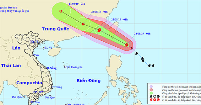
EnvironmentThis morning, August 23, typhoon Bailu is about 330km from Luzon Island, Philippines, level 12 whirlwind wind. Today and night, provinces from Thanh Hoa to Thua Thien Hu…
August 25, 2019
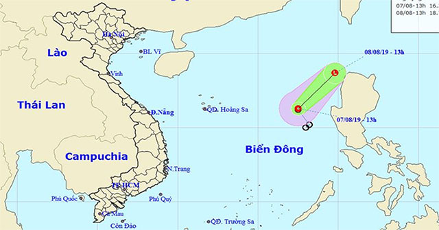
EnvironmentTonight and tomorrow, the waters from Binh Thuan to Kien Giang, the Gulf of Thailand, the South China Sea region have showers and thunderstorms.
August 7, 2019

Discover scienceChaos theory can be described as 'the science of surprises'.
August 2, 2019
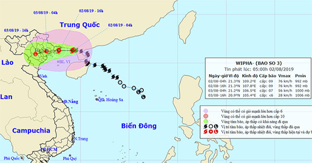
EnvironmentAt 04 o'clock, the location of the center of the storm is about 21.3 degrees Vi Bac; 109.2 degrees Kinh Dong, about 180 km from the mainland of Quang Ninh-Hai Phong prov…
August 2, 2019
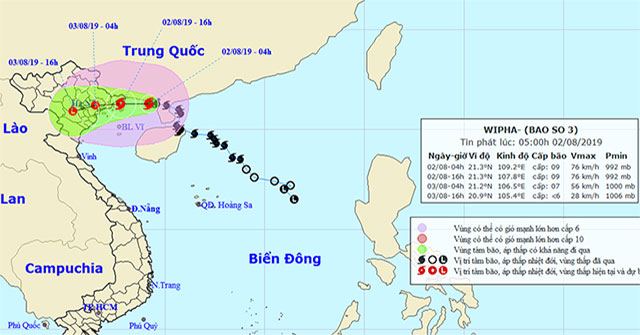
EnvironmentAround the evening and tonight (August 2), the storm entered the provinces from Quang Ninh to Nam Dinh with 10-11 winds.
August 2, 2019
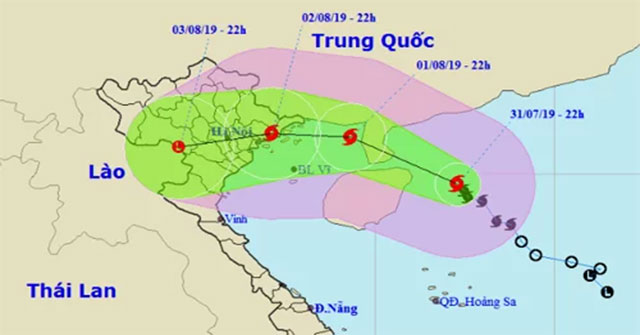
EnvironmentAt 0:00 on August 1, Hurricane Wipha with winds of 90km / h is only 120km from the Gulf of Tonkin, forecast to cause heavy rain for the North East from this afternoon.
August 1, 2019
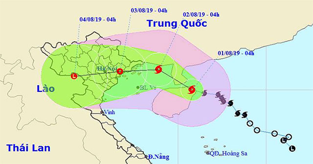
EnvironmentIn the past 3 hours, the storm No. 3 moved mainly in the North direction.
August 1, 2019
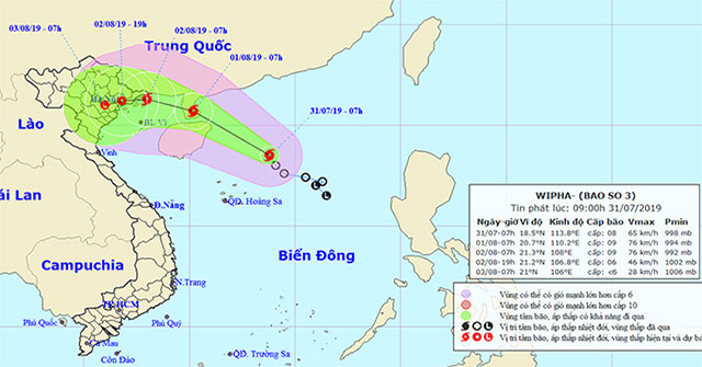
EnvironmentThis morning (July 31), the tropical low pressure on the North East Sea became strong into a storm (storm No. 3 in 2019) and the international name is WIPHA.
July 31, 2019
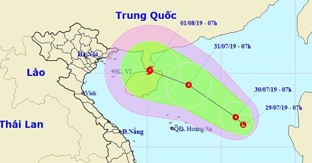
EnvironmentThe low pressure area that has just formed in the South China Sea is likely to intensify into a tropical depression and face the Vietnamese mainland.
July 29, 2019
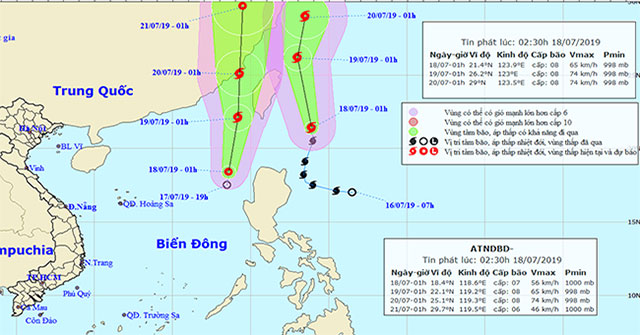
EnvironmentAccording to the National Center for Meteorological and Hydrological Forecasting, there are storms of Danas and newly formed tropical depressions, causing level 3 disast…
July 18, 2019
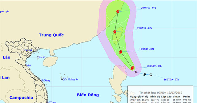
EnvironmentEarly this morning (July 17), Typhoon Danas entered the northeastern coast of the island of Luke (Philippines), the strongest wind in the area near the center of strong…
July 17, 2019
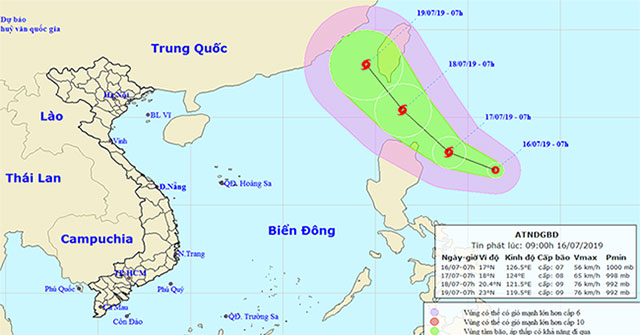
EnvironmentThis morning, July 16, on the east coast of Luzon Island, the Philippines has a tropical depression operating with the highest winds of level 6-7 (40-60km / h), shock le…
July 17, 2019
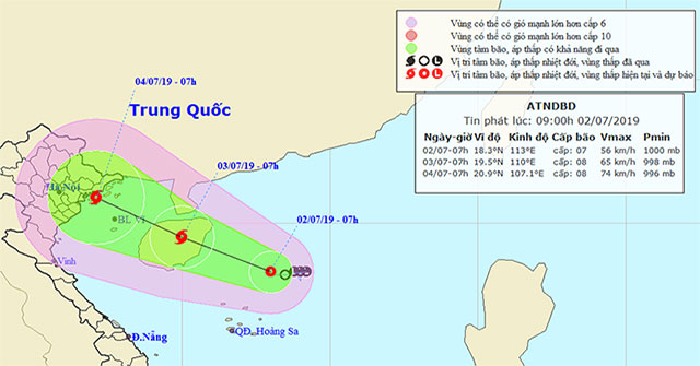
EnvironmentThe National Center for Hydro-Meteorological Forecasting stated that in the next hours, tropical depressions in the East Sea are likely to become strong storms and move…
July 3, 2019
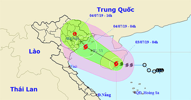
EnvironmentOn the evening of July 2, the tropical depression operated on the East Sea and became a storm with the international name Mun.
July 3, 2019
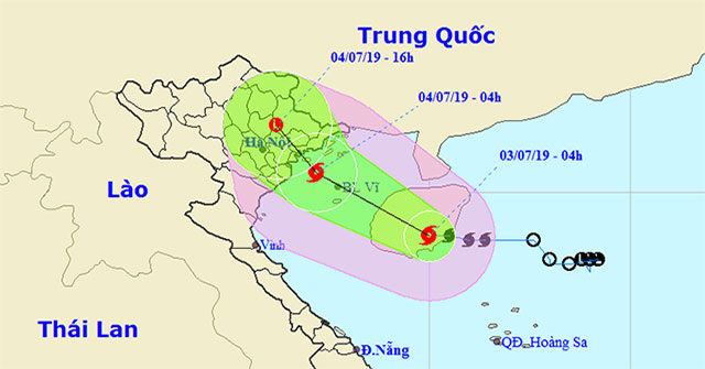
EnvironmentAt 07:00 on July 3, the location of the center of the storm was about 19.2 degrees north latitude; 109.3 Kinh Dong, on the western part of Hainan Island (China), about 2…
July 3, 2019