Environment
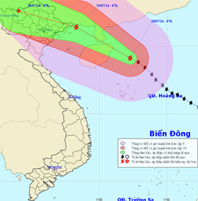
Thunderstorm speed accelerated deep into the Gulf of Tonkin
At 07:00 on July 18, the location of the center of the storm was about 19.1 degrees North latitude; 112.3 degrees Kinh Dong, 570km from Mong Cai (Quang Ninh) to the Sout…
Browse ScienceInfo articles and explainers related to Location.
536 published items.
At 07:00 on July 18, the location of the center of the storm was about 19.1 degrees North latitude; 112.3 degrees Kinh Dong, 570km from Mong Cai (Quang Ninh) to the Sout…
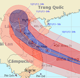
Typhoon Haiyan is considered one of the strongest storms in the history of hydrometeorology in the world as well as in Vietnam.
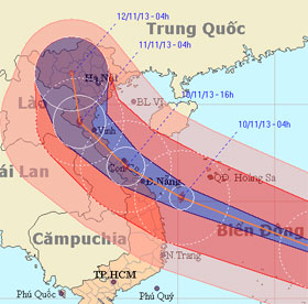
As the first island to receive a historic storm, this morning, Song Tu Tay had rain, strong winds hissed. Typhoon has weakened slightly with a gust of 133km / h.
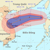
At 10 o'clock on November 1, the position of the center of the storm was about 19.0 degrees north latitude; 118.7 degrees Kinh Dong, about 740 km from Hoang Sa archipela…
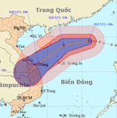
At 04:00 on November 2, the location of the center of the storm was about 19.4 degrees North latitude; 116.0 degrees Kinh Dong, about 510 km from Hoang Sa archipelago to…
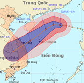
At 07:00 on November 2, the location of the center of the storm was about 19.5 degrees North latitude; 115.8 degrees Kinh Dong, 490 km from Hoang Sa archipelago to the N…
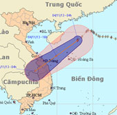
At 4 o'clock on November 4, the position of the center of the storm is about 18.9 degrees North latitude; 112.9 degrees east longitude, about 240 km from Hoang Sa archip…
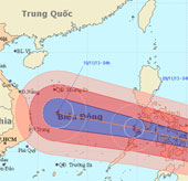
At 04:00 on November 7, the location of the storm center is about 8.4 degrees North; 133.6 Kinh Dong, about 780km from Min - Da - Nao Island (Philippines) to the East.
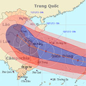
At 04:00 on November 8, the location of the center of the storm is about 10.8 degrees Vi Bac; 125.9 degrees east longitude, on the east coast of central Philippines
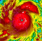
Haiyan typhoon, the most highly rated in the world this year, is landing in the Philippines with an average wind speed of 310km / h.
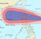
Currently, a storm is operating in the Eastern Philippines and has an international name of KROSA.
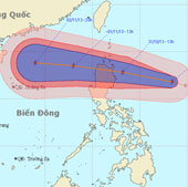
At 13:00 on October 30, the location of the center of the storm is about 16.8 degrees Vi Bac; 128.4 degrees Kinh Dong, about 670km from Lu-Dong Island (Philippines) to t…
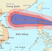
At 01:00 on October 31, the location of the center of the storm is about 17.5 degrees north latitude; 125.4 degrees Kinh Dong, about 340km from Lu-Dong Island (Philippin…
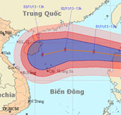
At 13 o'clock on October 31, the location of the center of the storm was about 18.0 degrees north latitude; 123.1 degrees east longitude, on the northeastern coast of Lu…
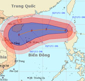
Early this morning (November 1), hurricane KROSA crossed Lu-Dong Island (Philippines) into the northeastern area of the East Sea - the storm No. 12.