Environment
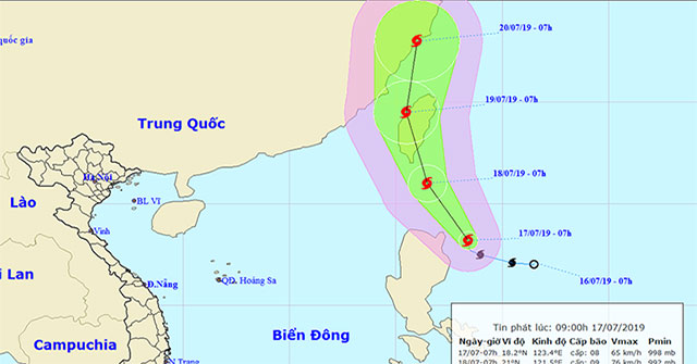
Danas storms level 10 toward the East Sea
Early this morning (July 17), Typhoon Danas entered the northeastern coast of the island of Luke (Philippines), the strongest wind in the area near the center of strong…
Browse ScienceInfo articles and explainers related to Storm Level.
19 published items.
Early this morning (July 17), Typhoon Danas entered the northeastern coast of the island of Luke (Philippines), the strongest wind in the area near the center of strong…

The floating design of American company Arkup provides housing solutions for areas where frequent storms are subject to frequent storms.

Understanding more about storms makes it easier for people to control the consequences caused by them. But studying storms is a difficult problem.

According to Rutledge, people in Asia, Europe and North America will be able to see this special event if they leave the towns with too much artificial light.
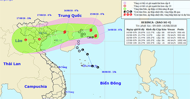
At 07:00 on August 14, the location of the center of the storm was about 20.8 degrees Vi Bac; 113.7 degrees Kinh Dong, on the southern coast of Guangdong province (China…
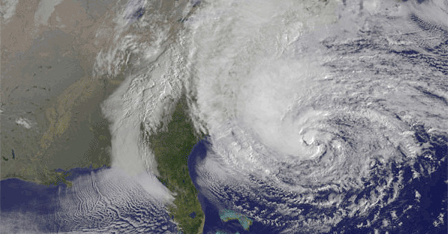
According to the regulations of the Western Pacific storms (areas with VN), when the wind does not exceed 63 km / hour, it is called a tropical depression.
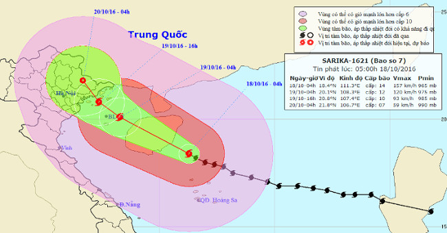
At 04:00 on October 18, the location of the center of the storm was about 18.4 degrees north latitude; 111.3 Kinh Dong, about 190km from Hoang Sa archipelago to the Nort…
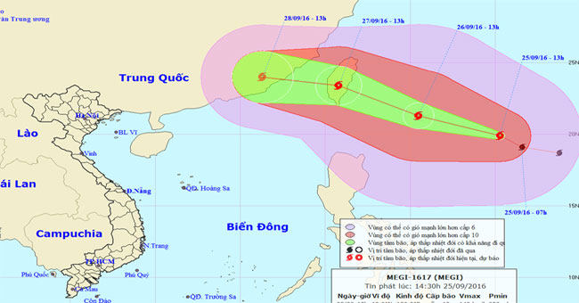
Currently (September 25), in the offshore waters of northeastern Lu-Dong Island (Philippines) a strong storm is active and has an international name as MEGI.
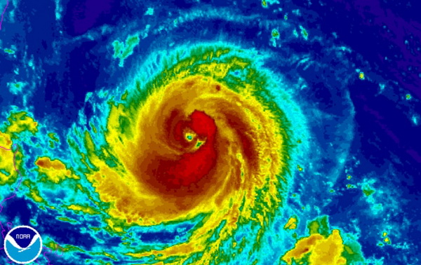
According to the Central Center for Meteorological and Hydrological Forecasting, at present, a very strong storm is operating in the waters off the Eastern Philippines a…
At 01:00 on 12/8, the location of the storm center is about 16.2 degrees Vi Bac; 122.2 degrees Kinh Dong, on the southeastern region of Lu - Dong (Philippines).
After entering the East Sea, storm Jebi is getting stronger. The storm is expected to sweep through Hainan Island (China) with a strong intensity of level 10 before ente…
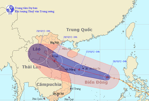
At 4 o'clock on October 26, the location of the center of the storm is about 14.5 degrees Vi Bac; 116.4 degrees Kinh Dong, about 520 km from Hoang Sa archipelago to the…
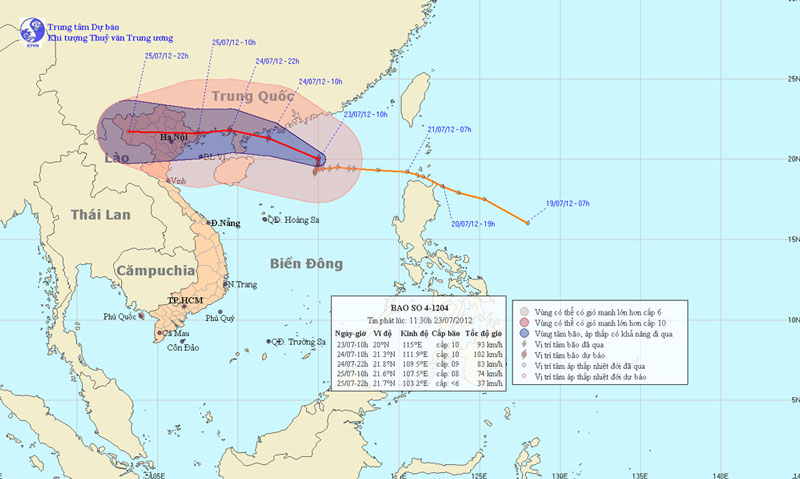
Vicente - the fourth storm to operate in the South China Sea - is gradually increasing, expected to land in Quang Ninh - Hai Phong waters on the morning of July 25. Hano…
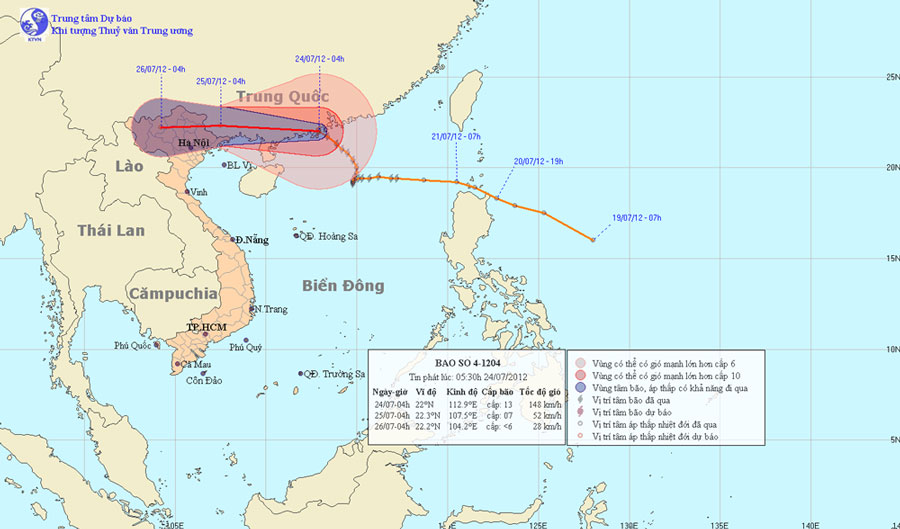
At 04 hours on July 24, the location of the center of the storm is about 22.0 degrees Vi Bac; 112.9 degrees Kinh Dong, about 540 km from Mong Cai (Quang Ninh) to the Eas…
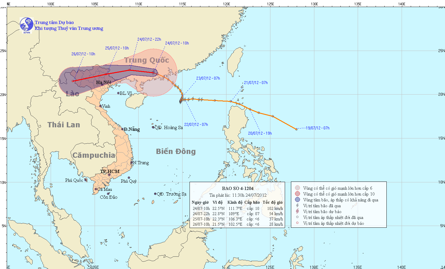
At 10 am on July 24, the location of the center of the storm is about 22.5 degrees north latitude; 111.7 degrees Kinh Dong, about 400 km from Mong Cai (Quang Ninh) to th…