
On the evening of July 2, the tropical depression operated on the East Sea and became a storm with the international name Mun.

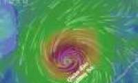
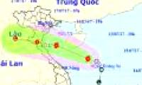
This morning (June 5) after entering the northwestern area of the Hoang Sa archipelago, the tropical depression intensified into a storm (storm No. 02 in 2018).

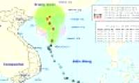
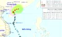
At 07:00 on 06/6, the location of the storm center No. 2 (EWINIAR) was about 20.7 degrees Vi Bac; 110.5 degrees Kinh Dong, on the area east of Leizhou Peninsula.

The National Center for Meteorology and Hydrology said that there is a notable form at present that a tropical cyclone will enter the South China Sea around 27-28 Tet.

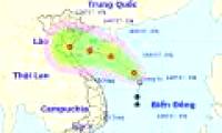
According to the Central Center for Meteorological and Hydrological Forecasting, this morning, the low pressure on the Hoang Sa archipelago waters, the highest wind level is 60 km

The Center for Hydro-meteorological Forecasting said that on the afternoon of July 15, the tropical low pressure on the Hoang Sa archipelago has become a storm, becoming the No. 2

At 1:00 on July 17, Talas stormed into the border area between Nghe An and Ha Tinh with 10-degree wind, many trees and electric poles collapsed.

Due to the impact of typhoon 2, a long heavy rain caused many roads and streets in the Capital to be deeply submerged in the water.

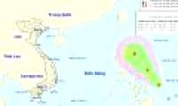
According to the Central Intelligence Center, on July 28, a tropical depression existed in the Eastern Philippines.

At 08:00 on August 1, the location of the center of the storm is about 20.1 degrees North latitude; 118.9 degrees Kinh Dong, about 560 km southeast of Hong Kong.
 On the evening of July 2, the tropical depression operated on the East Sea and became a storm with the international name Mun.
 This morning (June 5) after entering the northwestern area of the Hoang Sa archipelago, the tropical depression intensified into a storm (storm No. 02 in 2018).
 At 07:00 on 06/6, the location of the storm center No. 2 (EWINIAR) was about 20.7 degrees Vi Bac; 110.5 degrees Kinh Dong, on the area east of Leizhou Peninsula.
 The National Center for Meteorology and Hydrology said that there is a notable form at present that a tropical cyclone will enter the South China Sea around 27-28 Tet.
 According to the Central Center for Meteorological and Hydrological Forecasting, this morning, the low pressure on the Hoang Sa archipelago waters, the highest wind level is 60 km
 The Center for Hydro-meteorological Forecasting said that on the afternoon of July 15, the tropical low pressure on the Hoang Sa archipelago has become a storm, becoming the No. 2
 At 1:00 on July 17, Talas stormed into the border area between Nghe An and Ha Tinh with 10-degree wind, many trees and electric poles collapsed.
 Due to the impact of typhoon 2, a long heavy rain caused many roads and streets in the Capital to be deeply submerged in the water.
 According to the Central Intelligence Center, on July 28, a tropical depression existed in the Eastern Philippines.
 At 08:00 on August 1, the location of the center of the storm is about 20.1 degrees North latitude; 118.9 degrees Kinh Dong, about 560 km southeast of Hong Kong.



 Why did the ancient Babylonian civilization perish? Was it because they considered 'that thing' a daily meal?
 Just discovered a 72km 'tear in the Earth', the world's second largest country is in fear of a tsunami attack
 Top 7 facts about the hottest place in the world, where you can fry eggs at outdoor temperature
 The Qing Dynasty collapsed, what surname did 20,000 royal descendants change to to integrate into the new era?
 After 389 days in the Arctic, costing more than $160 million, hundreds of scientists brought back bad news: What was it?
 How long does it take to fall in love with someone?
 How much silver has ever been discovered in the world?
 How does an atomic bomb work?