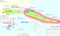
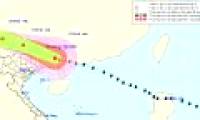
At 4 o'clock on September 12, the location of the storm center is about 20.6 degrees north latitude; 116.1 degrees Kinh Dong, about 570km from Hainan Island (China) to the East
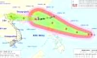
At 10 o'clock on September 12, the location of the storm center is about 20.7 degrees Vi Bac; 114.9 degrees Kinh Dong, about 470 km away from Loi Chau Peninsula (China) to the
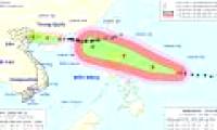
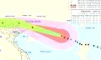
Super typhoon Mangkhut jerked on level 17 is forecast to move west-northwest, every hour is 20-25km and into the Northeast Sea.
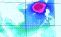
Mangkhut will enter the South China Sea and the area of anticipated influence covers the Gulf of Tonkin.
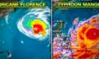
Countries in East and Southeast Asia have issued emergency alerts and ordered evacuation when both Typhoon Mangkhut and the second storm - Hurricane Barijat attacked the area.

Tropical Depression 26W formed on September 7 to quickly strengthen into super typhoon Mangkhut in the Western Pacific region.

According to the National Center for Hydrometeorological Forecasting, early this morning (September 15), super typhoon Mangkhut landed on the northern island of Luzon

At 4 o'clock on September 16, the location of the storm center is about 20.2 degrees north latitude; 116.2 degrees Kinh Dong, in the Northeast of the East Sea, about 400km from

According to RT, super typhoon Florence began to land in the eastern coastal provinces of the United States. Another storm, called Helene, is forming in the east of the ocean and

At 04:00 on September 17, the location of the center of the storm was about 22.6 degrees north latitude; 109.3 degrees east longitude, on land south of Guangdong province (China).
 At 4 o'clock on September 12, the location of the storm center is about 20.6 degrees north latitude; 116.1 degrees Kinh Dong, about 570km from Hainan Island (China) to the East
 At 10 o'clock on September 12, the location of the storm center is about 20.7 degrees Vi Bac; 114.9 degrees Kinh Dong, about 470 km away from Loi Chau Peninsula (China) to the
 Super typhoon Mangkhut jerked on level 17 is forecast to move west-northwest, every hour is 20-25km and into the Northeast Sea.
 Mangkhut will enter the South China Sea and the area of anticipated influence covers the Gulf of Tonkin.
 Countries in East and Southeast Asia have issued emergency alerts and ordered evacuation when both Typhoon Mangkhut and the second storm - Hurricane Barijat attacked the area.
 Tropical Depression 26W formed on September 7 to quickly strengthen into super typhoon Mangkhut in the Western Pacific region.
 According to the National Center for Hydrometeorological Forecasting, early this morning (September 15), super typhoon Mangkhut landed on the northern island of Luzon
 At 4 o'clock on September 16, the location of the storm center is about 20.2 degrees north latitude; 116.2 degrees Kinh Dong, in the Northeast of the East Sea, about 400km from
 According to RT, super typhoon Florence began to land in the eastern coastal provinces of the United States. Another storm, called Helene, is forming in the east of the ocean and
 At 04:00 on September 17, the location of the center of the storm was about 22.6 degrees north latitude; 109.3 degrees east longitude, on land south of Guangdong province (China).

 NASA's 'Ninth Planet' Shows Signs of Being Friendly to Life
 Why did American astronauts have to be quarantined when returning to Earth?
 China surprises the world by building a cable-stayed bridge 'above the clouds'
 Why do women sleep less and wake up more than men?
 Revealing the secret inside the stuffed animal claw machine, from there, summarizing experience to help you increase your winning rate many times over
 What would happen if you dug a hole through the Earth and jumped in?
 Camera takes a photo that lasts 1,000 years
 Was there nuclear war in ancient times?