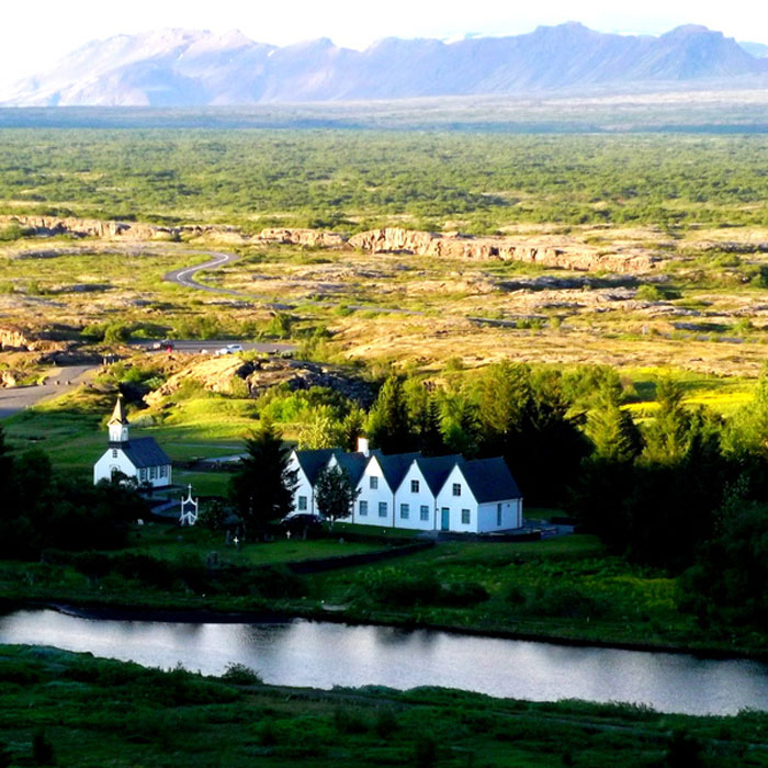
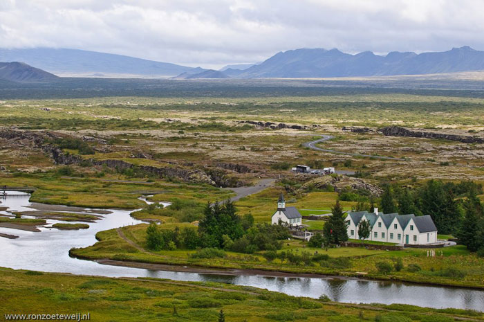
Þingvellir National Park (Thingvellir)
Unesco's Scientific, Educational and Cultural Organization has recognized Þingvellir National Park of Iceland as a World Heritage Site in 2004.

Þingvellir National Park is also known for being more familiar with Thingvellir National Park , located in Blaskogabyggo in Arnessysla, southwestern Iceland island.
Thingvellir National Park is an area of geological, historical and cultural importance, and is also a popular tourist area in Iceland. Founded in 1928, Thingvellir National Park is the first national park to be established and recognized in Iceland. The original purpose of establishing a garden was to preserve the values of the Þingvellir General Assembly building . This building was used from 930 to 1789. After that time, the national park was expanded to protect the natural values and the surrounding natural environment.

The historical area of Þingvellir (Thingvellir) formerly known as the Bláskógar region , with its suitable geographical location and natural and climate environment, has been chosen as the site for the construction of the grand council building and the horse grazing. This land has a special historical and cultural value because it is the foundation of the formation of the current Icelandic parliament. Besides, this land is also considered to be the historic center of the country.

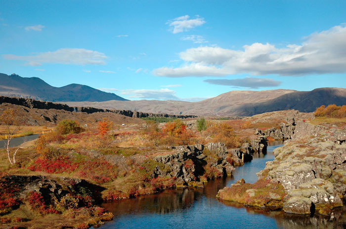
Þingvellir (Thingvellir) National Park is special because it is a unique geological environment and a volcanic place . The geological area is unstable with fractures due to the drift of the Eurasian continent and the North American continent.
In Thingvellir National Park, there is a very famous crack because it is a crack between the two continental boundaries of Europe - America that is Silfra .

Silfra Valley is part of the Mid Atlantic Ridge in the middle of the Atlantic Ocean, which is also the dividing line between the two continents of Europe - America. Mid Atlantic Ridge is the longest mountain range in the world, but most of this range is now submerged by the Atlantic Ocean. Silfra Valley is like a large crack on the surface of the earth because here the continental rocks slowly split and expand about 2 cm each year.
In the Atlantic Ocean due to the depth of the crack, it is difficult to see with the naked eye but in the Silfra Valley, due to the melting of the ice, it is clear to see this gap clearly.

It is because the fissure can be seen with the naked eye and can reach this area so Silfra valley is very famous and attracts tourists, especially those who love diving. Not only professional divers but also amateur divers can swim here and see the cracks as well as the underwater species. The special attraction is that when diving here, divers can touch both continents of Europe and America.

Although beautiful and attractive, the reason Silfra Valley became an ideal destination in Iceland is because the water here is very cold. The average water temperature is around -2 to -4 degrees Celsius and remains the same all year round. Cold temperatures make the water clearer and cleaner because of the lack of micro-organisms and marine life. Not only that, the Silfra valley water is considered to be the purest in the world because the water here is melted from snow on the Hofsjokull mountain , 50 km away. Water after melting down to penetrate into the rock and then flow to Thingvellir National Park. The process of water flowing from Hofsjokull mountain to Thingvellir National Park flows through many natural purifications thanks to the lava rock ranges along the way. The water here is so pure that one can drink it directly without any processing. Its purity, purity has been assessed many times by scientists.

However, because the area is built up from the caves, it is under the perennial depth so their structure is not really durable and can collapse if there is a strong impact. So dive to discover cracks here is not absolutely safe and few people dare to dive really deep. So far, many studies have come to study and understand the values and geology of this area, among them American experts have delineated the area but only a small earthquake has can change the geography of this area.

- Yor-Don National Park calls for help
- Te Wahipounamu, southwestern New Zealand national parks
- Rhino in Cat Tien National Park is under threat
- Detecting toad, mint banana in Xuan Son National Park
- Discover new lizards in Peru National Park
- Managing and protecting Bai Tu Long National Park
- Discover the village over 1000 years old in the US national park
- The stunning scenery of Plitvice National Park, Croatia
- The boy touched the two continents at the same time
- Forest restoration solution in Cat Ba National Park
- The government allowed the expansion of Bach Ma National Park
- Follow the foot of the bull - Cycle 1: Traces between the forest
 Suzhou classic bonsai garden - China
 Chau Nguyen Dynasty
 Thai Son Mountain - World Wonder
 Ancient villages of Shirakawa-go and Gokayama