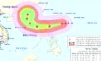
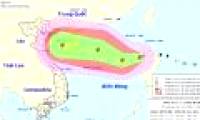
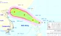
In about 24 storms moving mainly in the West, about 670km from Hoang Sa archipelago to the East.
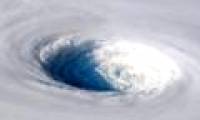
Astronaut Alexander Gerst, on the International Space Station (ISS), captured the image of super typhoon Trami, the fifth super typhoon raging in the Western Pacific this year.
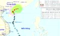
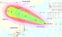
At 07:00 on 06/6, the location of the storm center No. 2 (EWINIAR) was about 20.7 degrees Vi Bac; 110.5 degrees Kinh Dong, on the area east of Leizhou Peninsula.

The central hydro-meteorological center said that 7 hours today, there was Sanba storm on the southern coast of Philippines, maximum wind speed of 75 km / h, level 8.

Early this morning, December 21, another tropical depression in the waters off the eastern coast of the south of the Philippines became a strong storm and the international name

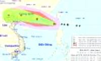
This morning (October 13), Typhoon Khanun crossed the northern island of Lebanon (Philippines) and entered the South China Sea, storm No. 11.

At 04:00 on September 13, the location of the center of the storm was about 14.8 degrees Vi Bac; 117.5 degrees Kinh Dong, about 610 km from Hoang Sa archipelago to the East of

Hurricane No. 10 is a dangerous storm, when entering the Gulf of Tonkin, it is still strong at level 12, level 15 jerks. For the first time, level 4 warning level is given.

On the morning of August 22, Typhoon Hato crossed north of Luzon Island (Philippines) and entered the East Sea, becoming the sixth storm of the year.

Early in the morning (August 25), in a sea off the southeastern island of Lu-Dong (Philippines), a storm with the international name of Pakhar formed.
 In about 24 storms moving mainly in the West, about 670km from Hoang Sa archipelago to the East.
 Astronaut Alexander Gerst, on the International Space Station (ISS), captured the image of super typhoon Trami, the fifth super typhoon raging in the Western Pacific this year.
 At 07:00 on 06/6, the location of the storm center No. 2 (EWINIAR) was about 20.7 degrees Vi Bac; 110.5 degrees Kinh Dong, on the area east of Leizhou Peninsula.
 The central hydro-meteorological center said that 7 hours today, there was Sanba storm on the southern coast of Philippines, maximum wind speed of 75 km / h, level 8.
 Early this morning, December 21, another tropical depression in the waters off the eastern coast of the south of the Philippines became a strong storm and the international name
 This morning (October 13), Typhoon Khanun crossed the northern island of Lebanon (Philippines) and entered the South China Sea, storm No. 11.
 At 04:00 on September 13, the location of the center of the storm was about 14.8 degrees Vi Bac; 117.5 degrees Kinh Dong, about 610 km from Hoang Sa archipelago to the East of
 Hurricane No. 10 is a dangerous storm, when entering the Gulf of Tonkin, it is still strong at level 12, level 15 jerks. For the first time, level 4 warning level is given.
 On the morning of August 22, Typhoon Hato crossed north of Luzon Island (Philippines) and entered the East Sea, becoming the sixth storm of the year.
 Early in the morning (August 25), in a sea off the southeastern island of Lu-Dong (Philippines), a storm with the international name of Pakhar formed.
 NASA's 'Ninth Planet' Shows Signs of Being Friendly to Life
 Why did American astronauts have to be quarantined when returning to Earth?
 China surprises the world by building a cable-stayed bridge 'above the clouds'
 Why do women sleep less and wake up more than men?
 Revealing the secret inside the stuffed animal claw machine, from there, summarizing experience to help you increase your winning rate many times over
 What would happen if you dug a hole through the Earth and jumped in?
 Camera takes a photo that lasts 1,000 years
 Was there nuclear war in ancient times?