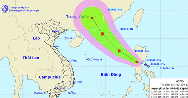
EnvironmentAt 01:00 on June 12, the location of the tropical depression was about 15.8 degrees North latitude; 120.7 degrees Kinh Dong, right on the east coast of Luang Prabang Isl…
June 14, 2020

EnvironmentAfter landing in Binh Dinh and Phu Yen provinces with the strongest wind of 90 km / h (grade 9), level 11 shock, Typhoon Matmo weakened into a tropical depression.
November 11, 2019

EnvironmentAt 13:00 on November 5, the location of the tropical depression was about 13.8 degrees North latitude; 115.1 degrees Kinh Dong, about 270km to the north of Song Tu Tay I…
November 11, 2019
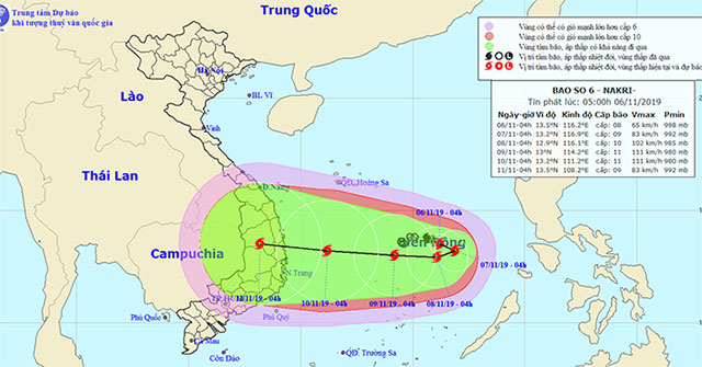
EnvironmentAt 04:00 on November 6, the location of the storm center was approximately 13.5 degrees Vi Bac; 116.2 degrees Kinh Dong, about 310km from Song Tu Tay Island (Spratly Isl…
November 11, 2019
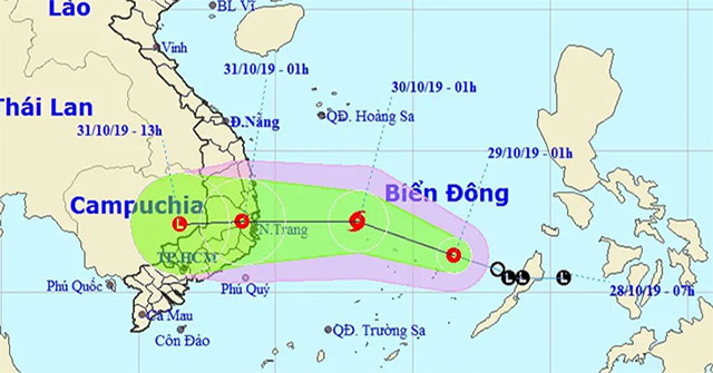
EnvironmentAccording to the National Center for Hydrometeorological Forecasting, the tropical depression on the sea moves quickly in the Northwestern direction, every hour it trave…
October 30, 2019
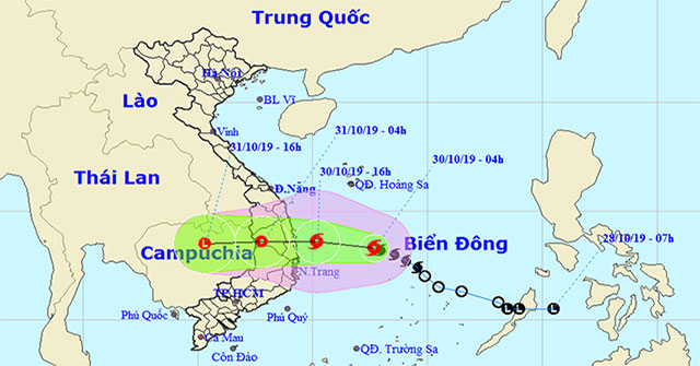
EnvironmentIn the evening of October 29, the tropical depression became the 5th storm in the East Sea with a maximum wind of 75 km / h (grade 8), directed to the provinces of Binh…
October 30, 2019
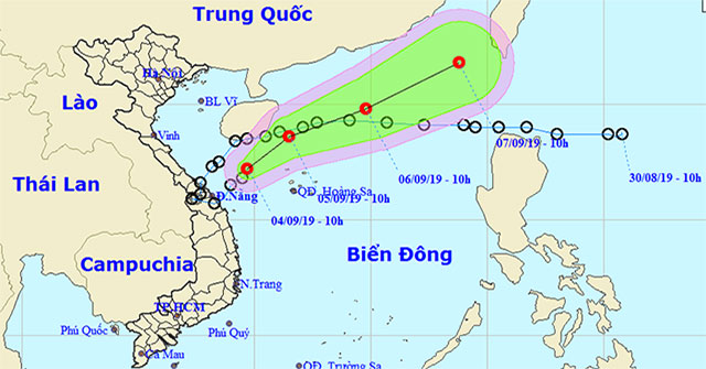
EnvironmentAfter landing on the central coast, tropical depression Kajiki returned to the sea and weakened into a low pressure area.
September 4, 2019
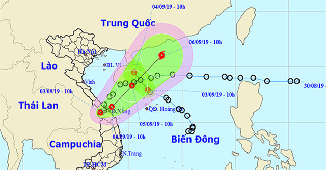
EnvironmentTropical Depression (tropical depression), known internationally as Kajiki, continues to move to the northeast and could become a typhoon in the next three days.
September 4, 2019
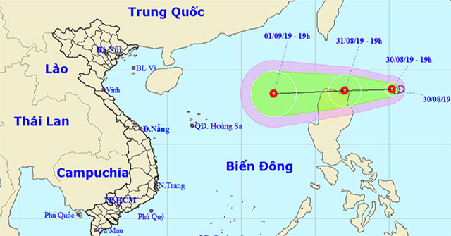
EnvironmentAccording to the National Center for Hydrometeorological Forecasting, a tropical depression about 350km to the east of Luzon Island (Philippines) is heading to the East…
August 31, 2019
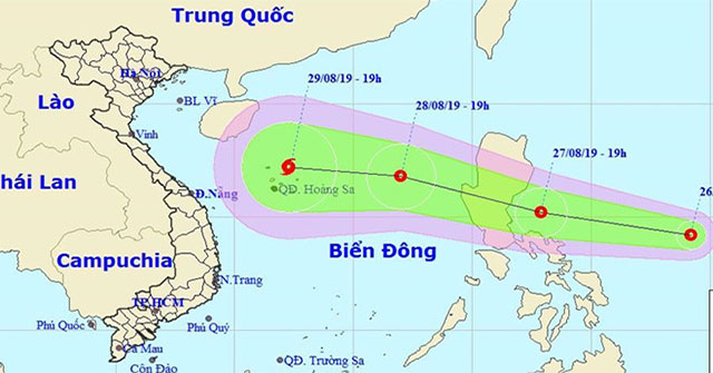
EnvironmentTropical depressions near the South China Sea are forecast to be able to become storms and enter the South China Sea region around August 28-29.
August 27, 2019
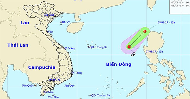
EnvironmentTonight and tomorrow, the waters from Binh Thuan to Kien Giang, the Gulf of Thailand, the South China Sea region have showers and thunderstorms.
August 7, 2019
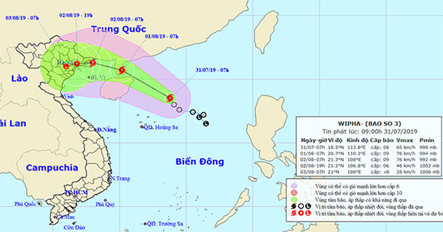
EnvironmentThis morning (July 31), the tropical low pressure on the North East Sea became strong into a storm (storm No. 3 in 2019) and the international name is WIPHA.
July 31, 2019
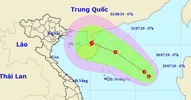
EnvironmentThe low pressure area that has just formed in the South China Sea is likely to intensify into a tropical depression and face the Vietnamese mainland.
July 29, 2019
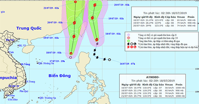
EnvironmentAccording to the National Center for Meteorological and Hydrological Forecasting, there are storms of Danas and newly formed tropical depressions, causing level 3 disast…
July 18, 2019
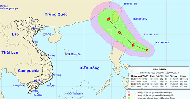
EnvironmentThis morning, July 16, on the east coast of Luzon Island, the Philippines has a tropical depression operating with the highest winds of level 6-7 (40-60km / h), shock le…
July 17, 2019