
Top 8 longest rivers in Vietnam
In Vietnam, due to heavy rainfall, a very large number of rivers and streams have been created, up to about 2,360 large and small rivers and canals.
In Vietnam, due to heavy rainfall conditions, a large number of rivers and streams have been created, up to about 2,360 large and small rivers and canals. Along the coast, about 23 km there is a river mouth and according to statistics there are 112 river mouths to the sea. Large rivers in Vietnam often originate from outside, the midlands and downstream flow on Vietnamese land. Most rivers in Vietnam flow in the Northwest - Southeast direction and empty into the East Sea.
The longest rivers in Vietnam
1. Dong Nai River
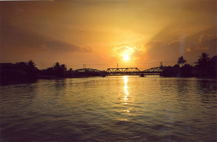
Dong Nai River is the longest inland river in Vietnam.
It is the longest inland river in Vietnam. The Dong Nai River originates from the Langbiang Plateau (Lam Dong) with a total length of 586km. With a huge water flow, it is an abundant source of hydropower for the Dong Nai Hydroelectric Plant. The Dong Nai River flows through the provinces of Lam Dong, Dak Nong, Binh Phuoc, Dong Nai, Binh Duong, and Ho Chi Minh City with a length of over 437km and a basin of 38,600km². If calculated from the source of the Da Dang River, it is 586km long, and if calculated from the confluence with the Da Nhim River below Pongour Falls, it is 487km long. The Dong Nai River flows into the East Sea in Can Gio district.
The main stream of the Dong Nai River in the upper reaches is also called the Da Dang River. The river originates from the Lam Vien plateau, meandering in the Northeast - Southwest direction, crossing the mountains to the plains in Ta Lai (Tan Phu district, Dong Nai province). The river is the natural boundary between Dak R'Lap (Dak Nong) and Bao Lam - Cat Tien (Lam Dong), between Cat Tien and Bu Dang (Binh Phuoc) - Tan Phu, between Tan Phu and Da Teh.
After meeting the Be River, the Dong Nai River forms a natural boundary between Dong Nai (Vinh Cuu) on the left bank - east and Binh Duong (Tan Uyen) on the right bank - west. Reaching Uyen Hung ward, Tan Uyen town, Binh Duong province, the Dong Nai River flows in a North - South direction, embracing Tan Uyen and Cu Lao Pho islands. Cu Lao Pho on the Dong Nai River was a bustling place for the Minh Huong community before this land became an official administrative unit of Dang Trong in 1698.
The Dong Nai River flows through Bien Hoa City, then flows along the border between Dong Nai (Long Thanh, Nhon Trach) and Ho Chi Minh City (District 9, District 2, District 7, Nha Be, Can Gio), between Ba Ria - Vung Tau (Phu My) and Ho Chi Minh City (Can Gio). The main stream of the Dong Nai River is in the lower reaches, from the confluence of the Saigon River to the bifurcation into Soai Rap and Long Tau, commonly called Nha Be River. Old books call this river "Phuoc Binh".
2. Da River
The main stream of the Da River flows into Vietnam at Mu Ca, Muong Te.
The Da River, also known as the Bo River or Da Giang , is the largest tributary of the Red River. The river is 910 km long (some documents say 983 km), with a basin area of 52,900 km². The main stream originates from Vo Luong Mountain, Yunnan Province, China, flowing northwest - southeast to join the Red River in Phu Tho. The river section in Vietnam is 527 km long (some documents say 543 km). The starting point is the Vietnam-China border in Muong Te District (Lai Chau). The river flows through the northwestern provinces of Vietnam, including Lai Chau, Dien Bien, Son La, Hoa Binh, Phu Tho (dividing Thanh Thuy District, Phu Tho with Ba Vi, Hanoi). The end point is the Hong Da junction, Tam Nong District, Phu Tho Province.
The main stream of the Da River enters Vietnam at Mu Ca, Muong Te. The first section of the river in Vietnam, the Da River is also called Nam Te, runs along the border and meets the Tieu Hac tributary at Mu Ca, Muong Te. The Tieu Hac tributary enters Vietnam at Ka Lang commune, Muong Te, flows along the border to the west and joins the main stream of the Da River at Mu Ca.
The Da River has a large water flow, providing 31% of the water for the Red River and is a major hydroelectric resource for the Vietnamese electricity industry. In 1994, the Hoa Binh Hydroelectric Plant was inaugurated with a capacity of 1,920 MW with 8 turbines. In 2005, the Son La Hydroelectric Project with a designed capacity of 2,400 MW was started. The Lai Chau 1,200 M hydroelectric plant is under construction. Construction started in 2011, expected to be completed in December 2016 in the upper reaches of this river. The basin has great resource potential with many rare minerals, typical ecosystems including biological resources with high biodiversity.
3. Red River
The Red River has a very large average annual water flow.
The Red River has a total length of 1,149 km, originating in China, flowing through Vietnam and emptying into the East Sea. The section flowing in Vietnam is 510 km long. This is an important river of the Vietnamese rice culture. The first point of contact of the Red River with the Vietnamese territory is in A Mu Sung commune (Bat Xat district, Lao Cai province). In Lao Cai, the Red River is 73 m above sea level. At Yen Bai, 145 km from Lao Cai, the river is only 55 m high. Between the two provinces are 26 rapids and rapids. At Viet Tri, the river slope is not very steep anymore so the flow speed slows down. The Red River Delta is located downstream of this river.
The Red River has a very large average annual water flow, up to 2,640 m³/s (at the river mouth) with a total water flow of up to 83.5 billion m³, however the water flow is unevenly distributed. In the dry season, the flow decreases to only about 700 m³/s, but at the peak of the rainy season it can reach 30,000 m³/s.
4. Ma River
The Ma River mainly flows between mountainous and midland areas.
The Ma River is a river of Vietnam and Laos with a length of 512 km, of which the part in Vietnam is 410 km long and the part in Laos is 102 km long. The basin of the Ma River is 28,400 km² wide, the part in Vietnam is 17,600 km² wide, with an average elevation of 762 m, an average slope of 17.6%, and a density of rivers and streams in the entire basin of 0.66 km/km². The average annual water flow is 121 m³/s at Xa La and 341 m³/s at Cam Thuy. The Ma River mainly flows between the mountainous and midland areas. The alluvium of the Ma River is the main source that creates the Thanh Hoa Delta, the third largest in Vietnam. The Ma River flows along the depression between the two mountain ranges of Su Xung Chao Chai and Pu Sam Sao. The tributaries of the Ma River mostly originate from these two mountain ranges.
The Ma River begins at the confluence of streams in the Vietnam - Laos border area at Muong Loi commune, south of Dien Bien district (south of Dien Bien province) 21°0′49″N 103°7′38″E. Pu Lau village, north of Muong Loi commune, is located on a mountain ridge that is the watershed between Nam Nua, flowing northwest and belonging to the Mekong River system, and Nam Ma, flowing northeast, the headwaters of the Ma River, locally known as Se stream. The river flows into Dien Bien Dong, along the way receiving water from several streams in Hang Lia, Dien Bien Dong.
The river returns to Vietnam at Ten Tan border gate, Muong Lat, Thanh Hoa. From here, the river flows through Muong Lat, Quan Hoa, of which a small section passes through Quan Hoa district, which is the border between Thanh Hoa and Hoa Binh provinces. The Ma River system has a total length of 881 km, a total basin area of 39,756 km², of which 17,520 km² is located in Vietnam. The average annual water volume of the entire river system is 19.52 billion m³.
5. Lam River (Ca River)
Lam River is one of the two largest rivers in North Central Vietnam.
Lam River (other names: Ngan Ca, Song Ca, Nam Khan, Thanh Long Giang) is one of the two largest rivers in North Central Vietnam. The river originates from the Xiengkhuang plateau, Laos. The part flowing in Laos is called Nam Khan. The main part of the river flows through Nghe An, the last part of Lam River merges with La River from Ha Tinh, forming the border between Nghe An and Ha Tinh, flowing into the sea at Hoi estuary.
The total length of the river according to the Vietnamese Encyclopedia is about 512 km, the section flowing inland in Vietnam is about 361 km. However, other sources say that this river has two main sources, if calculated from the source from Nam Mon (from Pu Loi range), Lam River is 530 km long, if calculated from the source starting from Nam Mo (Tran Ninh plateau), the river is 432 km long. The basin area of this river is 27,200 km², of which 17,730 km² belongs to Vietnam.
On average, the Lam River is located at an altitude of 294 m and has an average slope of 18.3%. The density of rivers and streams is 0.60 km/km². From the Vietnam-Laos border to Cua Rao, the riverbed is steep with more than 100 rapids. From Cua Rao downstream, small boats can travel on the river during the flood season. The total water volume is 21.90 km³, corresponding to an average annual flow of 688 m³/s and an annual flow module of 25.3 l/s.km². The average annual flow at Cua Rao is 236 m³/s, at Dua: 430 m³/s. The flood season from June to November is also the rainy season, contributing about 74-80% of the total annual water volume.
6. Lo River
The Lo River section in Vietnam is 274km long.
The Lo River is a first-level tributary on the left bank of the Red River, flowing from China to the provinces of Ha Giang, Tuyen Quang and Phu Tho in Vietnam. The Lo River section in Vietnam is 274 km long (different books record from 264 km to 277 km), making it one of the five longest rivers in Northern Vietnam (Hong, Da, Lo, Cau, Day).
The 156 km section from Viet Tri junction to Tuyen Quang port, Tuyen Quang province, can be used by ships with a capacity of 100 to 150 tons in both seasons. The section from Tuyen Quang city to Ha Giang city, can be used by ships with a capacity of small capacity in the rainy season.
7. Mekong River
The Mekong River originates in the Qinghai-Tibet Plateau, China.
The Mekong River is one of the largest rivers in the world, originating from the Qinghai-Tibet Plateau where the river originates in Qinghai province, flowing through China, Laos, Myanmar, Thailand, Cambodia and emptying into the East Sea in Vietnam. In terms of length, it ranks 12th in the world with 4,350km, and in terms of water flow, it ranks 10th in the world. The average flow is 13,200 m³/s, during the flood season it can reach 30,000 m³/s. Its basin is about 795,000 km² (according to data from the Mekong River Commission). This river originates from the high mountains of Qinghai province, crosses Tibet along the length of Yunnan province (China), through Myanmar, Thailand, Laos, Cambodia before entering Vietnam.
Starting from Phnom Penh, it divides into two branches: the right is the Ba Thac River (in Vietnam called Hau Giang or Hau River) and the left is the Mekong (in Vietnam called Tien Giang or Tien River), both of which flow into the vast delta region in Southern Vietnam, about 220 - 250 km long each. In Vietnam, the Mekong River is also called the Big River or the Cai River.
Scientists are finding creatures such as sardines, catfish, giant stingrays, sharp-toothed gars, and large, carnivorous carps in the Mekong River, which can weigh up to 200 pounds and grow to over 6 feet long, according to the World Wildlife Fund. In addition, the Mekong River is home to rare species of catfish and catfish, not to mention giant barbs and carps, making fishing tourism a thriving business here.
8. Flowing River
The flow of the Chay River is very complex, the riverbed is narrow, deep, steep slopes and many rapids.
The Chay River is a river in Northern Vietnam, originating from the southwest slope of Tay Con Linh peak (2,419 m) and the northeast slope of Kieu Lien Ti peak (2,402 m) on the upstream Chay River massif, northwest of Ha Giang province, crossing Lao Cai and Yen Bai provinces and flowing into the Lo River in Doan Hung, Phu Tho province with a length of 319 km.
The river's flow is very complex, the riverbed is narrow, deep, steep and has many rapids. In Ha Giang province, the river flows in an East-West direction through Vi Xuyen, Hoang Su Phi, Xin Man districts and then through Si Ma Cai district of Lao Cai province. In this section, about 5km of the Chay River is the Vietnam-China border between Lao Cai province and Yunnan province, China.
Chay River is a beautiful natural landscape for those who love ecotourism. In the dry season, the deepest part of the river is only about 3m, you can sit on an iron boat, go upstream to visit freely. On both sides of the river are the simple houses of the Mong, Dao, and Day people. Occasionally, you can also see bamboo rafts floating to exploit sand, in the distance is the road to Bac Ha like a white lime streak hanging on the mountainside.
- The second longest insect in the world is found in Vietnam
- Rivers are infected with antibiotics
- WWF publishes research on world river maps
- In the north, there is a widespread rain, and floods appear on the rivers
- 10 'dying' rivers of America (Part 1)
- The Amazon River is the longest in the world, so where is the shortest river?
- 10 major rivers in the world are under threat
- Scientist 'went out' to clean up rivers and lakes
- The longest lava cave in Southeast Asia in Vietnam
- Two more rivers disappeared after only one night in Mexico
The heartbreaking truth behind the image of the arctic river dyed red like blood Legend of the 'water monster' Da river How is the foundation of a bridge built? The 'farmer mutants' hunt treasure on the bottom of the Red River 70% of the Red River mouth area is in danger Water of the Red River through Lao Cai shallow record, strong odor Ecological crisis threatens the Mekong sub-region Sweden helps Vietnam cope with climate change