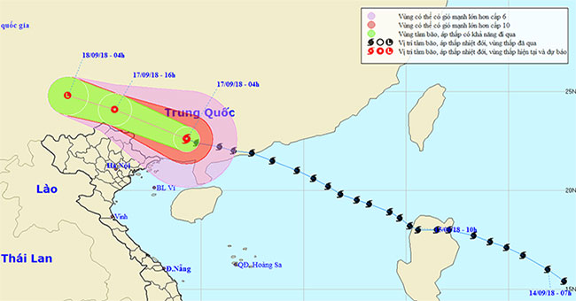
EnvironmentAt 04:00 on September 17, the location of the center of the storm was about 22.6 degrees north latitude; 109.3 degrees east longitude, on land south of Guangdong provinc…
December 16, 2018
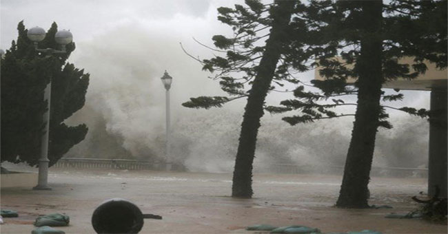
EnvironmentDeputy Director of Institute of Meteorology, Hydrology and Climate Change (Institute of Science and Technology and Climate Change) Mai Van Khiem gave an explanation abou…
December 16, 2018
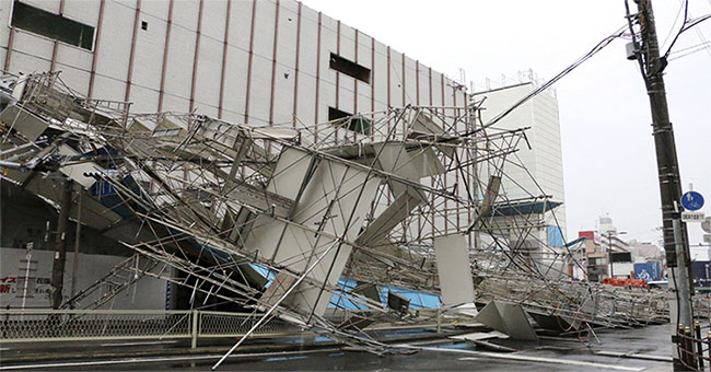
EnvironmentAs of today, at least 9 people have been killed when Typhoon Jebi, the strongest storm in 25 years, landed in western Japan, NHK reported, adding that more than 90 peopl…
December 16, 2018
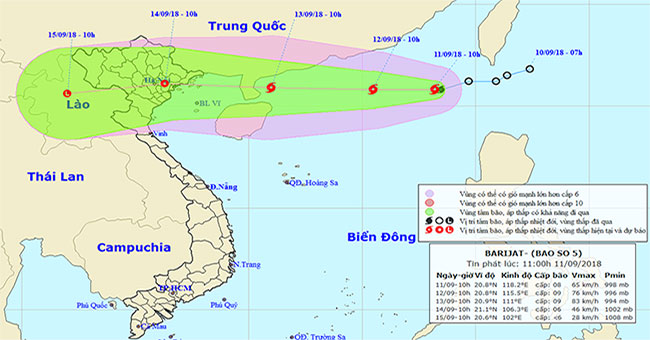
EnvironmentAt 10 am on 9/11, the location of the center of the storm was about 20.8 degrees Vi Bac; 118.2 degrees Kinh Dong, about 800km east of Hainan Island (China).
December 16, 2018
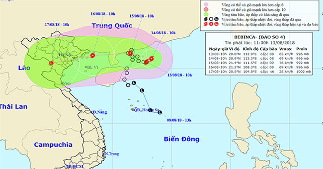
EnvironmentAt 10 o'clock, the location of the center of the storm was about 20.6 degrees North latitude; 112.9 Kinh Dong, on the southern coast of Guangdong Province (China).
December 16, 2018
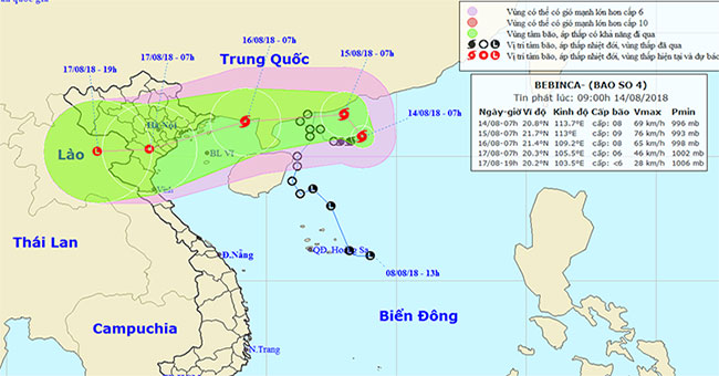
EnvironmentAt 07:00 on August 14, the location of the center of the storm was about 20.8 degrees Vi Bac; 113.7 degrees Kinh Dong, on the southern coast of Guangdong province (China…
December 16, 2018
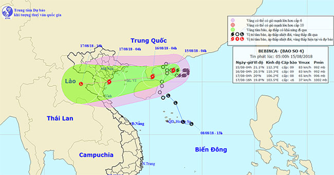
EnvironmentAt 04:00 on August 15, the location of the center of the storm was about 21.1 degrees north latitude; 112.3 degrees Kinh Dong, on the southern coast of Guangdong provinc…
December 16, 2018
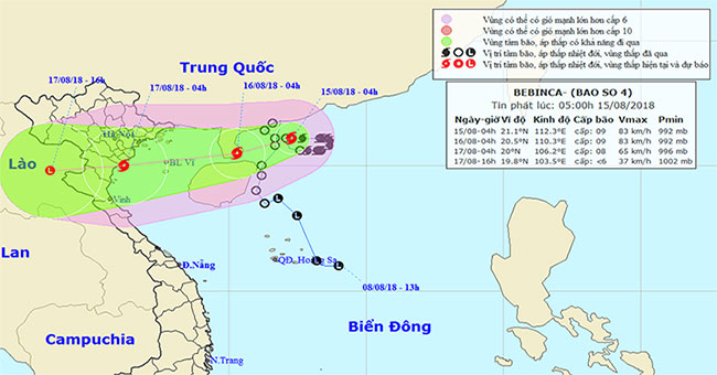
EnvironmentAccording to the Windy forecast page, the direction of the number 4 storm from the formation on the Tropical Depression is unpredictable, changing direction continuously.
December 16, 2018
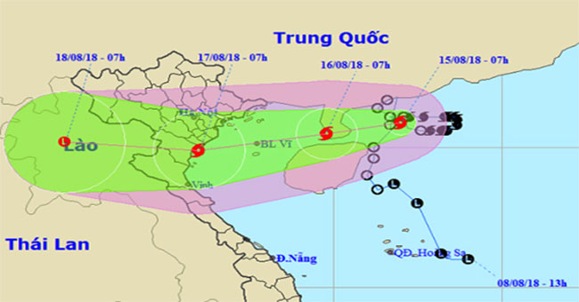
EnvironmentDue to changing direction from East to West and moving slowly, Bebinca 7h this morning is still in the southern waters of Guangdong Province (China), the maximum wind sp…
December 16, 2018
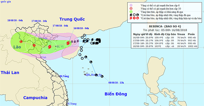
EnvironmentEarly this morning (August 16), Typhoon No. 4 passed Lui Chau peninsula and went to the east of the Gulf of Tonkin.
December 16, 2018
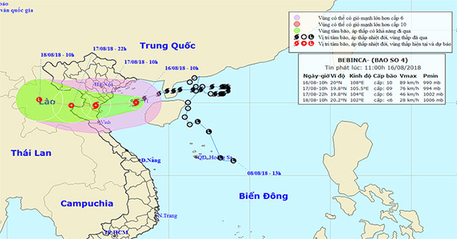
EnvironmentIn the Gulf of Tonkin earlier, Typhoon Bebinca moved faster, about 10-15 km per hour. At 8am, the storm center in Bach Long Vi Island, 180km from Mong Cai, 230km from Na…
December 16, 2018

EnvironmentAccording to the National Center for Hydro-Meteorological Forecasting, early August 17, the storm center No. 4 enters the mainland of Thanh Hoa province and will weaken…
December 16, 2018
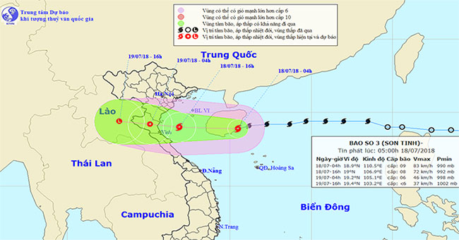
EnvironmentAt 04:00 on July 18, the location of the center of the storm was about 18.9 degrees north latitude; 110.5 degrees east longitude, on the eastern area of Hainan Island,…
December 16, 2018
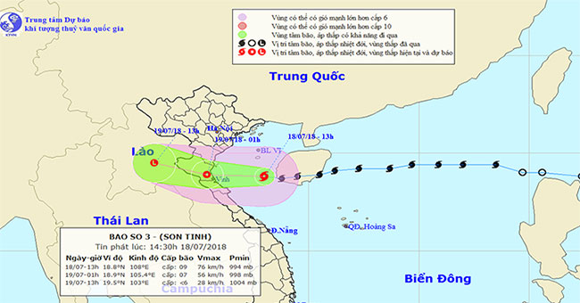
EnvironmentThis afternoon, the storm No. 3 passed Hai Nam Island and entered the Gulf of Tonkin, due to the storm, in Bach Long Vi Island, there was strong winds of level 7, level…
December 16, 2018
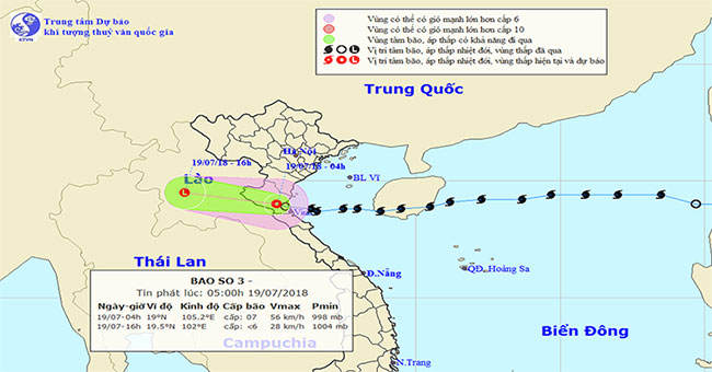
EnvironmentOn the night of July 18, the typhoon landed on the mainland, the center of storms in the coastal areas of Nghe An and Thanh Hoa provinces was strong at level 7.
December 16, 2018