At 10 o'clock on July 29, the location of the center of the storm was about 18.5 degrees north latitude; 112.3 degrees Kinh Dong, about 170 km from Hoang Sa archipelago to the

At 16 o'clock on July 29, the location of the center of the storm was about 19.2 degrees north latitude; 111.1 degrees east longitude, about 580km from Thai Binh - Ha Tinh

At 19:00 on July 29, the location of the center of the storm was about 19.5 degrees North latitude; 110.3 degrees Kinh Dong, about 490 km away from the coast of Thai Binh - Ha

At 04:00 on July 30, the location of the center of the storm was about 19.5 degrees North latitude; 108.4 degrees Kinh Dong, about 290km from the coast of Thai Binh - Ha Tinh to

Due to the impact of typhoon No 3, Co To island station has strong winds of 15m / s (level 7), shocking 27m / s (level 10); At Bach Long Vi island station, there is a strong wind

Due to the impact of storm No. 3, at Co To island station, there is strong wind of 15m / s (level 7), shocking 27m / s (level 10); At Bach Long Vi island station, there is strong

Due to the influence of typhoon 3, at Co To island station, there is strong wind of 17m / s (level 7), shocking 27m / s (level 10); At Bach Long Vi island station, there is a

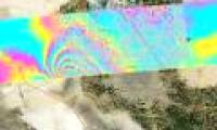
NASA scientists have come up with a new way of developing radar systems and aviation maps for earthquake alert purposes.

A NASA team has just succeeded in testing a tsunami prediction system using GPS data.

That is the judgment in the
 At 10 o'clock on July 29, the location of the center of the storm was about 18.5 degrees north latitude; 112.3 degrees Kinh Dong, about 170 km from Hoang Sa archipelago to the
 At 16 o'clock on July 29, the location of the center of the storm was about 19.2 degrees north latitude; 111.1 degrees east longitude, about 580km from Thai Binh - Ha Tinh
 At 19:00 on July 29, the location of the center of the storm was about 19.5 degrees North latitude; 110.3 degrees Kinh Dong, about 490 km away from the coast of Thai Binh - Ha
 At 04:00 on July 30, the location of the center of the storm was about 19.5 degrees North latitude; 108.4 degrees Kinh Dong, about 290km from the coast of Thai Binh - Ha Tinh to
 Due to the impact of typhoon No 3, Co To island station has strong winds of 15m / s (level 7), shocking 27m / s (level 10); At Bach Long Vi island station, there is a strong wind
 Due to the impact of storm No. 3, at Co To island station, there is strong wind of 15m / s (level 7), shocking 27m / s (level 10); At Bach Long Vi island station, there is strong
 Due to the influence of typhoon 3, at Co To island station, there is strong wind of 17m / s (level 7), shocking 27m / s (level 10); At Bach Long Vi island station, there is a
 NASA scientists have come up with a new way of developing radar systems and aviation maps for earthquake alert purposes.
 A NASA team has just succeeded in testing a tsunami prediction system using GPS data.
 That is the judgment in the


 Strange 'rich people's MSG', once no one bothered to buy it
 More than 1,000 artifacts unearthed on Mount Wudang
 Why did Empress Dowager Cixi eat 20 eggs every day, but the chef had to prepare 500?
 8 mystical medieval books that are even scarier the more you read them
 The majestic natural scenery is overwhelming on the most dangerous road in the world
 Strange wood with the ability to change color: Ranked among the world's top in hardness and durability, Vietnam also grows it
 What's inside the world's largest Three Gorges Dam?
 The Y chromosome is gradually disappearing, predicting that men have a new sex gene