
Environment
Typhoon Tembin made landfall in South Korea causing much damage
After sweeping the provinces of Central and Eastern China, on August 30, Typhoon Tembin landed on the southern coast of South Korea and caused much damage.
Browse ScienceInfo articles and explainers related to Rough.
105 published items.
After sweeping the provinces of Central and Eastern China, on August 30, Typhoon Tembin landed on the southern coast of South Korea and caused much damage.
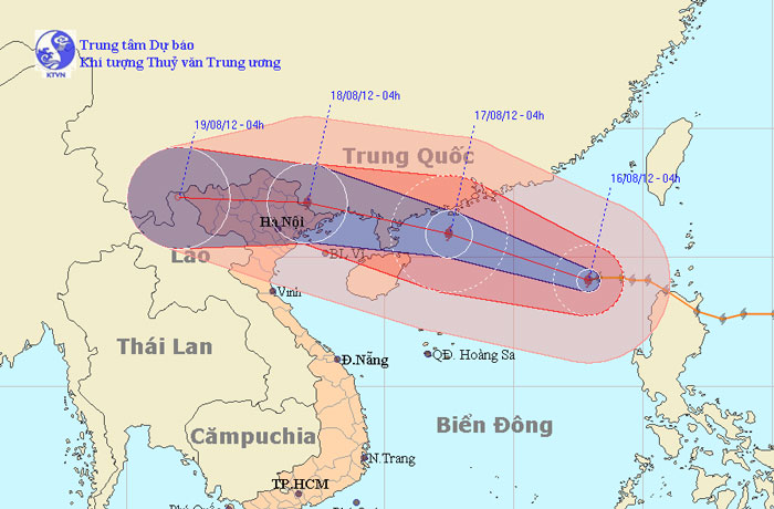
At 04:00 on August 16, the location of the center of the storm was about 19.1 degrees North latitude; 117.9 Kinh Dong, about 670km from Hoang Sa archipelago to the East…
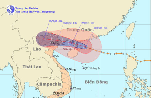
At 04:00 on August 17, the location of the center of the storm was about 20.5 degrees north latitude; 112.1 degrees Kinh Dong, 470 km from Mong Cai (Quang Ninh) to the E…
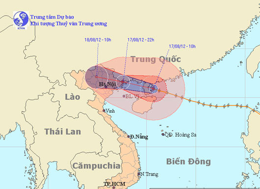
At 10 o'clock on August 17, the location of the storm center is about 20.9 degrees North latitude; 110.7 degrees Kinh Dong, about 320km from Mong Cai (Quang Ninh) to the…
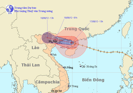
At 13:00 on August 17, the location of the center of the storm was about 21.1 degrees north latitude; 109.9 Kinh Dong, on the northwestern area of Leizhou Peninsula (C…
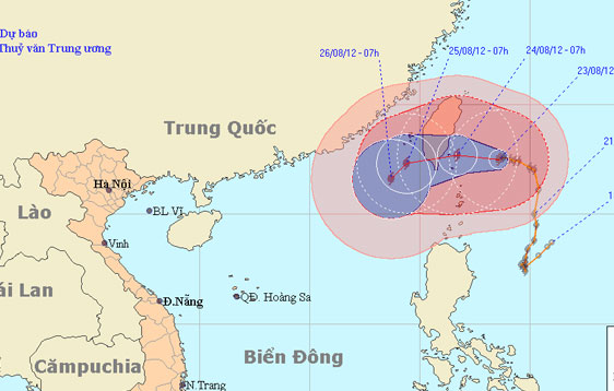
According to the Central Center for Meteorological and Hydrological Forecasting, at 1 hour on August 23, the location of the center of Typhoon TemBin is about 22.6 degre…
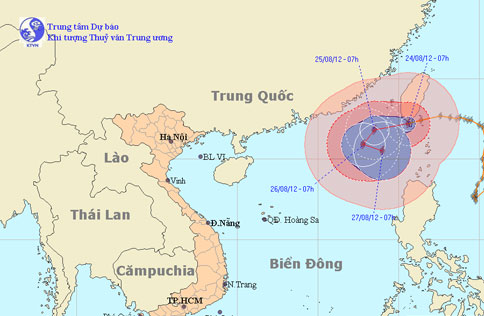
At 7 o'clock on August 24, the location of the center of the storm was about 22.2 degrees Vi Bac; 120.6 degrees Kinh Dong, on the southern island of Taiwan (China). The…
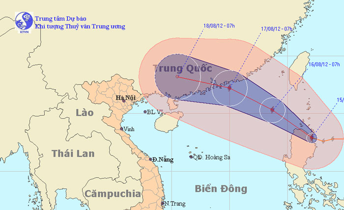
At 07:00 on August 15, the location of the center of the storm was about 17.9 degrees Vi Bac; 122.1 degrees Kinh Dong, on the northern area of Lu - Dong Island (Philip…
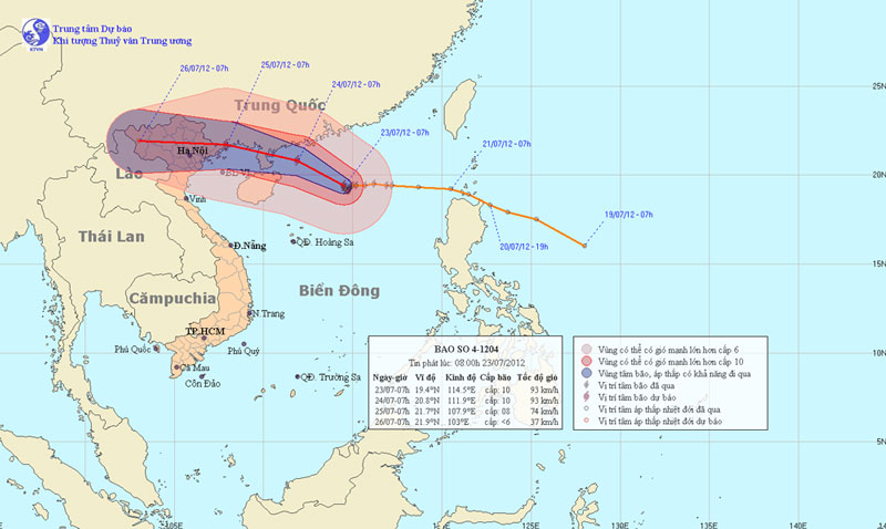
At 07:00 on July 23, the location of the center of the storm was about 19.4 degrees north latitude; 114.5 degrees Kinh Dong, 390 km from Hoang Sa archipelago to the Nort…
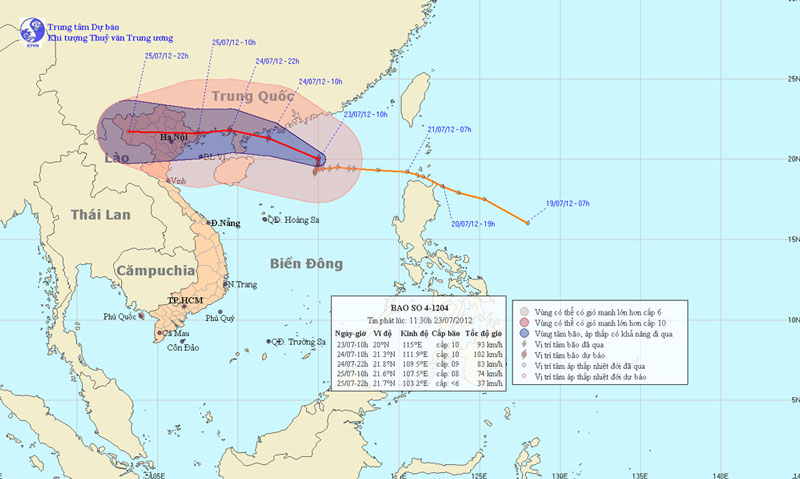
Vicente - the fourth storm to operate in the South China Sea - is gradually increasing, expected to land in Quang Ninh - Hai Phong waters on the morning of July 25. Hano…
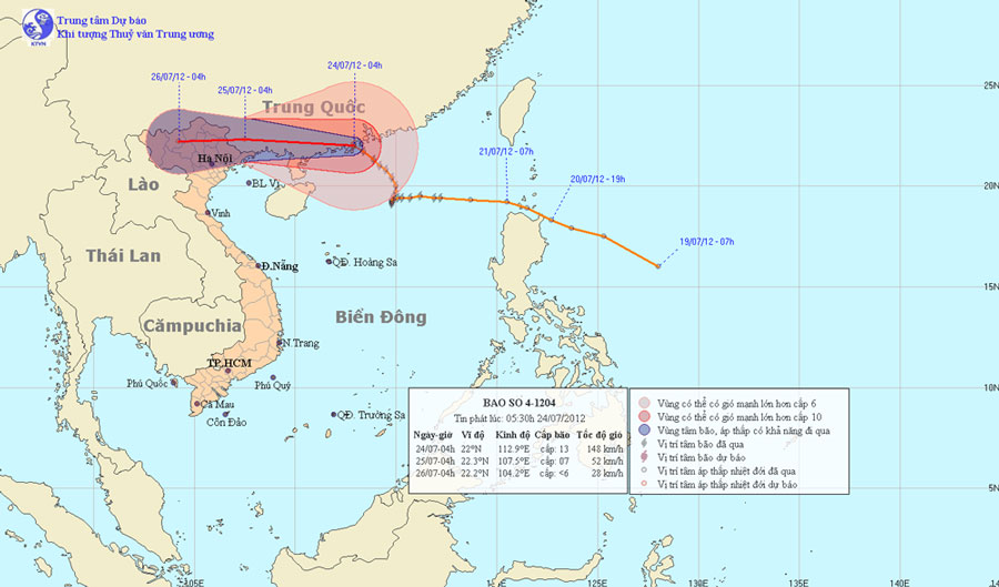
At 04 hours on July 24, the location of the center of the storm is about 22.0 degrees Vi Bac; 112.9 degrees Kinh Dong, about 540 km from Mong Cai (Quang Ninh) to the Eas…
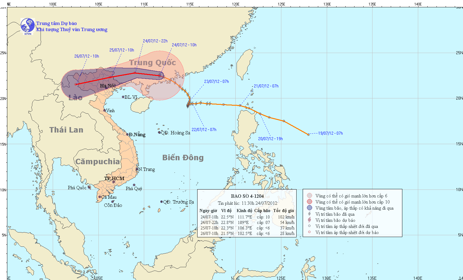
At 10 am on July 24, the location of the center of the storm is about 22.5 degrees north latitude; 111.7 degrees Kinh Dong, about 400 km from Mong Cai (Quang Ninh) to th…

More than 100 people were injured and many trees fell down when Typhoon Vicente hit Hong Kong last night with winds of up to 140km / h, officials said today.
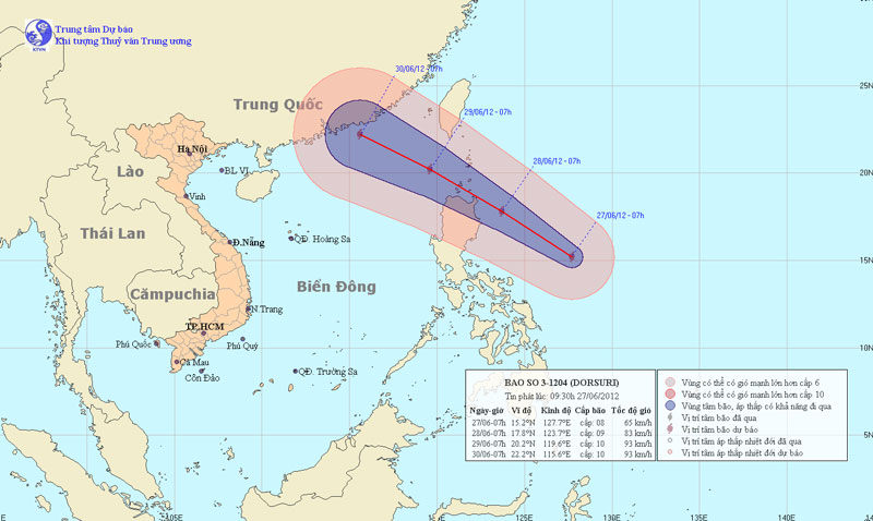
Currently, in the East Sea of Luong Island (Philippines) a storm is active and the international name is Doksuri. At 7 am on June 27, the location of the center of the…
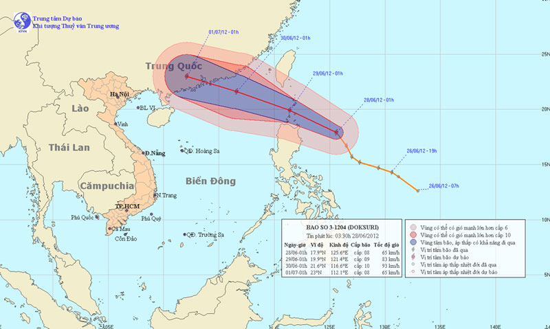
At 01:00 on June 28, the location of the storm center is about 17.9 degrees North latitude; 125.6 Kinh Dong, about 380km from Lu-Dong Island (Philippines) to the East. T…